Essex Township, Kankakee County, Illinois
| Essex Township | |
|---|---|
| Township | |
 Location in Kankakee County | |
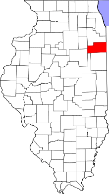 Kankakee County's location in Illinois | |
| Coordinates: 41°09′32″N 88°11′19″W / 41.15889°N 88.18861°WCoordinates: 41°09′32″N 88°11′19″W / 41.15889°N 88.18861°W | |
| Country | United States |
| State | Illinois |
| County | Kankakee |
| Established | August 1, 1855 |
| Government | |
| • Supervisor | Don Babjak |
| Area | |
| • Total | 36.23 sq mi (93.8 km2) |
| • Land | 35.64 sq mi (92.3 km2) |
| • Water | 0.59 sq mi (1.5 km2) 1.63% |
| Elevation | 584 ft (178 m) |
| Population (2010) | |
| • Estimate (2016)[1] | 1,414 |
| • Density | 41.5/sq mi (16.0/km2) |
| Time zone | UTC-6 (CST) |
| • Summer (DST) | UTC-5 (CDT) |
| ZIP codes | 60424, 60481, 60913, 60917, 60935, 60941, 60961 |
| FIPS code | 17-091-24465 |
Essex Township is one of seventeen townships in Kankakee County, Illinois, USA. As of the 2010 census, its population was 1,480 and it contained 686 housing units.[2]
Geography
According to the 2010 census, the township has a total area of 36.23 square miles (93.8 km2), of which 35.64 square miles (92.3 km2) (or 98.37%) is land and 0.59 square miles (1.5 km2) (or 1.63%) is water.[2]
Cities, towns, villages
Adjacent townships
- Reed Township, Will County (north)
- Custer Township, Will County (northeast)
- Salina Township (east)
- Pilot Township (southeast)
- Norton Township (south)
- Greenfield Township, Grundy County (west)
- Braceville Township, Grundy County (northwest)
Cemeteries
The township contains these two cemeteries: North Essex and South Essex.
Major highways
Airports and landing strips
- Lagrange Airport
- Rashs Acres Airport
Demographics
| Historical population | |||
|---|---|---|---|
| Census | Pop. | %± | |
| Est. 2016 | 1,414 | [1] | |
| U.S. Decennial Census[3] | |||
Government
The township is governed by an elected Town Board of a Supervisor and four Trustees. The Township also has an elected Assessor, Clerk, Highway Commissioner and Supervisor. The Township Office is located at 315 North Pine, Essex, IL 60935.
Political districts
- Illinois' 11th congressional district
- State House District 75
- State Senate District 38
School districts
- Herscher Community Unit School District 2
- Reed Custer Community Unit School District 255U
References
- "Essex Township, Kankakee County, Illinois". Geographic Names Information System. United States Geological Survey. Retrieved 2010-02-20.
- United States Census Bureau 2007 TIGER/Line Shapefiles
- United States National Atlas
- 1 2 "Population and Housing Unit Estimates". Retrieved June 9, 2017.
- 1 2 "Population, Housing Units, Area, and Density: 2010 - County -- County Subdivision and Place -- 2010 Census Summary File 1". United States Census. Retrieved 2013-05-28.
- ↑ "Census of Population and Housing". Census.gov. Retrieved June 4, 2016.
External links
Municipalities and communities of Kankakee County, Illinois, United States | ||
|---|---|---|
| Cities | ||
| Villages | ||
| Townships | ||
| Unincorporated communities |
| |
| Footnotes | ‡This populated place also has portions in an adjacent county or counties | |
This article is issued from
Wikipedia.
The text is licensed under Creative Commons - Attribution - Sharealike.
Additional terms may apply for the media files.