Sun River Terrace, Illinois
| Sun River Terrace | |
|---|---|
| Village | |
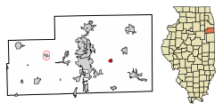 Location of Sun River Terrace in Kankakee County, Illinois. | |
.svg.png) Location of Illinois in the United States | |
| Coordinates: 41°7′35″N 87°44′5″W / 41.12639°N 87.73472°WCoordinates: 41°7′35″N 87°44′5″W / 41.12639°N 87.73472°W | |
| Country | United States |
| State | Illinois |
| County | Kankakee |
| Area[1] | |
| • Total | 0.57 sq mi (1.47 km2) |
| • Land | 0.56 sq mi (1.46 km2) |
| • Water | 0.00 sq mi (0.00 km2) |
| Elevation | 622 ft (190 m) |
| Population (2010) | |
| • Total | 528 |
| • Estimate (2016)[2] | 514 |
| • Density | 909.73/sq mi (351.03/km2) |
| Time zone | UTC-6 (CST) |
| • Summer (DST) | UTC-5 (CDT) |
| ZIP Code(s) | XXXXX |
| Area code(s) | 815 & 779 |
| FIPS code | 17-73943 |
| Wikimedia Commons | Sun River Terrace, Illinois |
| Website | http://www.sunriverterrace.com/home.html |
Sun River Terrace is a village in Kankakee County, Illinois, United States. The population was 383 at the 2000 census. It is included in the Kankakee-Bradley, Illinois Metropolitan Statistical Area.
Geography
Sun River Terrace is located at 41°07′35″N 87°44′05″W / 41.126508°N 87.734638°W.[3]
According to the 2010 census, Sun River Terrace has a total area of 0.561 square miles (1.45 km2), of which 0.56 square miles (1.45 km2) (or 99.82%) is land and 0.001 square miles (0.00 km2) (or 0.18%) is water.[4]
Demographics
| Historical population | |||
|---|---|---|---|
| Census | Pop. | %± | |
| 1990 | 532 | — | |
| 2000 | 383 | −28.0% | |
| 2010 | 528 | 37.9% | |
| Est. 2016 | 514 | [2] | −2.7% |
| U.S. Decennial Census[5] | |||
As of the census[6] of 2000, there were 383 people, 140 households, and 97 families residing in the village. The population density was 843.2 people per square mile (328.6/km²). There were 147 housing units at an average density of 323.6 per square mile (126.1/km²). The racial makeup of the village was 10.18% White, 88.25% African American, 0.78% from other races, and 0.78% from two or more races. Hispanic or Latino of any race were 2.09% of the population.
There were 140 households out of which 33.6% had children under the age of 18 living with them, 35.7% were married couples living together, 30.7% had a female householder with no husband present, and 30.7% were non-families. 27.1% of all households were made up of individuals and 16.4% had someone living alone who was 65 years of age or older. The average household size was 2.74 and the average family size was 3.30.
In the village, the population was spread out with 33.2% under the age of 18, 8.9% from 18 to 24, 23.0% from 25 to 44, 19.8% from 45 to 64, and 15.1% who were 65 years of age or older. The median age was 34 years. For every 100 females, there were 84.1 males. For every 100 females age 18 and over, there were 82.9 males.
The median income for a household in the village was $26,875, and the median income for a family was $31,875. Males had a median income of $22,344 versus $24,750 for females. The per capita income for the village was $11,692. About 14.3% of families and 17.5% of the population were below the poverty line, including 16.5% of those under age 18 and 19.6% of those age 65 or over.
References
- ↑ "2016 U.S. Gazetteer Files". United States Census Bureau. Retrieved Jun 30, 2017.
- 1 2 "Population and Housing Unit Estimates". Retrieved June 9, 2017.
- ↑ "US Gazetteer files: 2010, 2000, and 1990". United States Census Bureau. 2011-02-12. Retrieved 2011-04-23.
- ↑ "G001 - Geographic Identifiers - 2010 Census Summary File 1". United States Census Bureau. Retrieved 2015-12-25.
- ↑ "Census of Population and Housing". Census.gov. Retrieved June 4, 2015.
- ↑ "American FactFinder". United States Census Bureau. Retrieved 2008-01-31.
Municipalities and communities of Kankakee County, Illinois, United States | ||
|---|---|---|
| Cities | ||
| Villages | ||
| Townships | ||
| Unincorporated communities |
| |
| Footnotes | ‡This populated place also has portions in an adjacent county or counties | |