Srey Santhor District
| Srey Santhor ស្រុកស្រីសន្ធរ | |
|---|---|
| District (srok) | |
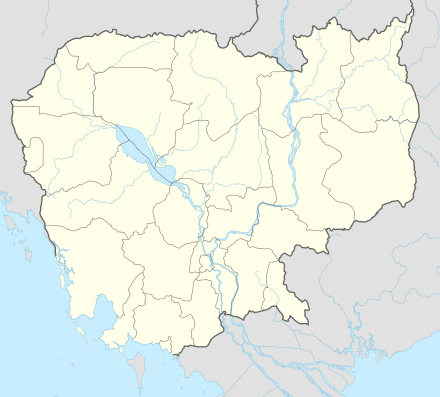 Srey Santhor Location in Cambodia | |
| Coordinates: 11°50′31″N 105°7′33″E / 11.84194°N 105.12583°E | |
| Country |
|
| Province | Kampong Cham |
| Communes | 14 |
| Villages | 86 |
| Government | |
| • Governor | Mr. Heng Vanny |
| Population (1998)[1] | |
| • Total | 91,765 |
| Time zone | +7 |
| Geocode | 0314 |
Srey Santhor District (Khmer: ស្រុកស្រីសន្ធរ) is a district (srok) located in Kampong Cham province, Cambodia. The district capital is Srey Santhor town located on the south bank of the Mekong River around midway between Phnom Penh and the provincial capital of Kampong Cham. Srey Santhor is in south western Kampong Cham and lies on the border with Kandal and Prey Veng provinces.[2] It was briefly the capital of Cambodia during the post-Angkor era from 1431 to 1434.
2000 Floods
Between July and November 2000, Cambodia was subject to catastrophic flooding in all provinces bordering the Mekong River. The Mekong literally burst it banks and Cambodia experienced the worst flooding in 70 years.[3] As most of Srey Santhor district is low lying and parallels the Mekong, Srey Santhor is subject to annual flooding when the Mekong rises. However, in 2000 90% of the land area in the district was flooded and 95% of the annual rice crop was completely destroyed.[4]
Location
Srey Santhor district is a central district of Kampong Cham Province. Reading from the north clockwise, Srey Santhor shares a border with Kang Meas District of Kampong Cham to the north across the Mekong. Koh Sotin district lies on the eastern border. To the south are Sithor Kandal and Pea Reang districts of Prey Veng Province. The western border of the district is shared with Khsach Kandal district of Kandal Province.[5]
Administration
The Srey Santhor district governor is Mr. Heng Vanny.[6] He reports to His Excellency Hun Neng, the Governor of Kampong Cham. The following table shows the villages of Srey Santhor district by commune.
| Khum (Commune) | Phum (Villages) |
|---|---|
| Baray | Sya Boeng Veaeng, Sya Ampil, Banteay, Kamphlak |
| Chi Bal | Khnor Doung, Slaeng, Chi Bal, Tang Krang, Khyaong |
| Khnar Sa | Angk, Kngaok, Treas, Khnar Sa, Ampil |
| Kaoh Andaet | Kbal Kaoh, Kokir, Chong Kaoh, Krouch Saeuch |
| Mean Chey | Veal, Moan Dab Leu, Moan Dab Kraom, Kaoh Kou, Chey, Samraong, Pok Paen |
| Pteah Kandal | Ou Leav, Phteah Kandal Leu, Phteah Kandal Kraom, Chong Boeng Krau |
| Pram Yam | Pram Yam, Kdei Thkar, Cheung Doek, Chi Pray |
| Preaek Dambouk | Ta Kay, Ta Meun, Ta Mol, Chong Boeng Knong, Preaek Dambouk Kraom, Preaek Dambouk Leu, Svay Mu, Ampil, Phteah Veal |
| Preaek Pou | Roka Tvear, Preaek Pou Leu, Preaek Pou Kraom, Chras, Prathnal, Kouk Char, Santey, Thma Da, Turi Leu, Turi Kandal, Turi Kraom, Prey Tbeh |
| Preaek Rumdeng | Kser, Ou Lang, Tnaot Ka, Tnaot Kha, Preaek Rumdeng Ka, Preaek Rumdeng Kha, Preaek Rumdeng Kho, Preaek Ouv Chrueng Ka, Preaek Ouv Chrueng Kha, Svay Ta Noan Ka, Svay Ta Noan Kha, Kampong Pnov, Ta Koch, Ta Ngak Thmei |
| Ruessei Srok | Tnaot Kraom, Prey Totueng, Ruessei Srok, Tnaot Leu |
| Svay Pou | Pou, Svay, Chi Pao, Teahean, Trea, Khvet |
| Svay Sach Phnum | Svay Leu, Svay Kandal, Svay Tboung, Svay Kraom |
| Tong Tralach | Tong Tralach, Boeng Ting, Khting, Chonloat Dai |
Demographics
The district is subdivided into 14 communes (khum) and 86 villages (phum).[7] According to the 1998 Census, the population of the district was 91,765 persons in 18,224 households in 1998. With a population of over 90,000 people, Srey Santhor district has an average district population for Kampong Cham province. The average household size in Srey Santhor is 5.0 persons per household, which is slightly lower than the rural average for Cambodia (5.2 persons). The sex ratio in the district is 92.0%, with significantly more females than males.[8]
References
- ↑ General Population Census of Cambodia, 1998: Village Gazetteer. National Institute of Statistics. February 2000. pp. 63–65.
- ↑ Total Road Atlas of Cambodia 2006 (3rd ed.). Total Cambodge. 2006. p. 44.
- ↑ "Cambodia gets $2m flood aid". BBC News. 26 October 2000. Retrieved 2009-02-10.
- ↑ Cruft, Jeremy (10 July 2001). "Impact Assessment of the Mekong River Floods of 2000" (PDF). Oxfam. p. 16. Retrieved 2009-02-14.
- ↑ "Kampong Cham Provincial Resources". Ministry of Commerce. Archived from the original on January 5, 2009. Retrieved 2009-01-25.
- ↑ "The Theory and Practice of Decentralisation and Deconcentration" (PDF). German Technical Co-operation (gtz). 4/3/2008. Retrieved 2009-02-08. Check date values in:
|date=(help) - ↑ "Kampong Cham Administration". Royal Government of Cambodia. Archived from the original on 2009-02-10. Retrieved 2009-02-08.
- ↑ General Population Census of Cambodia, 1998: Village Gazetteer. National Institute of Statistics. February 2000. pp. 32–73.
| Capital city |  | |
|---|---|---|
| Districts | ||
Coordinates: 11°50′31″N 105°7′33″E / 11.84194°N 105.12583°E