Somers, Wisconsin
| Somers, Wisconsin | |
|---|---|
| Village | |
 Location of Somers in Kenosha County, Wisconsin. | |
| Coordinates: 42°37′17″N 87°52′17″W / 42.62139°N 87.87139°W | |
| Country | United States |
| State | Wisconsin |
| County | Kenosha |
| Area[1] | |
| • Total | 25.274 sq mi (65.46 km2) |
| • Land | 25.257 sq mi (65.42 km2) |
| • Water | 0.017 sq mi (0.044 km2) |
| Elevation[2] | 679 ft (207 m) |
| Population (2010) | |
| • Total | 600 |
| • Estimate (2016)[3] | 8,300 |
| • Density | 3,384.99/sq mi (1,307.01/km2) |
| Time zone | UTC-6 (Central (CST)) |
| • Summer (DST) | UTC-5 (CDT) |
| Area code(s) | 262 |
| FIPS code | 55-74650[4] |
| GNIS feature ID | 1584173[2] |
Somers is a village[5] in Kenosha County, Wisconsin, United States. The population was 9,597 at the 2010 census, at which time the village was still a town. Somers has a post office with ZIP code 53171.[6]
The village of Somers was incorporated on April 24, 2015, following a local election that favored incorporation.[7] While the village originally only included the eastern half of the town's former boundaries, it now includes almost all of the original town; the remainder is still a town and is slated to become part of Kenosha by 2035.[8][9]
History
The community was originally named Pike on April 15, 1843 by an act of the Wisconsin territorial legislature,[10] and became Somers in 1851.[11]
Geography
According to the United States Census Bureau, the village has a total area of 25.274 square miles (65.46 km2), of which 25.257 square miles (65.42 km2) of it is land and 0.017 square miles (0.044 km2) of it is water.[12]
Berryville is a residential and business community located in the town of Somers, Wisconsin along the intersections of Kenosha County Highway A (7th Street) and Highway 32 (Sheridan Road). The community was named for the proliferation of strawberry farms in the area.[13] The Berryville School was a community fixture into the 1980s, when it was demolished for new housing. Adjacent to the school to the south was the Mid-City Outdoor Theatre (1948-1984), one of Wisconsin's first drive-in theatres.[14]
Demographics
| Historical population | |||
|---|---|---|---|
| Census | Pop. | %± | |
| Est. 2016 | 8,300 | [3] | |
| U.S. Decennial Census[15] | |||
As of the census[4] of 2000, there were 9,059 people, 3,399 households, and 2,226 families residing in the then-town. The population density was 296.9 people per square mile (114.6/km²). There were 3,552 housing units at an average density of 116.4 per square mile (45.0/km²). The racial makeup of the town was 91.57% White, 3.23% African American, 0.28% Native American, 1.24% Asian, 0.04% Pacific Islander, 1.92% from other races, and 1.72% from two or more races. Hispanic or Latino of any race were 4.10% of the population.
There were 3,399 households out of which 28.2% had children under the age of 18 living with them, 55.4% were married couples living together, 6.2% had a female householder with no husband present, and 34.5% were non-families. 27.4% of all households were made up of individuals and 6.5% had someone living alone who was 65 years of age or older. The average household size was 2.45 and the average family size was 3.00.
In the town, the population was spread out with 21.6% under the age of 18, 15.6% from 18 to 24, 28.5% from 25 to 44, 23.6% from 45 to 64, and 10.7% who were 65 years of age or older. The median age was 36 years. For every 100 females, there were 101.7 males. For every 100 females age 18 and over, there were 101.2 males.
The median income for a household in the town was $49,608, and the median income for a family was $66,003. Males had a median income of $41,649 versus $29,516 for females. The per capita income for the town was $23,837. About 2.4% of families and 5.6% of the population were below the poverty line, including 2.8% of those under age 18 and 4.1% of those age 65 or over.
Education
- Shoreland Lutheran High School is a private Christian high school of the Wisconsin Evangelical Lutheran Synod (WELS).
- The University of Wisconsin–Parkside is located in the village.
Notable people
- William H. Flett, Wisconsin legislator[16]
- Margaret Landon, author of Anna and the King of Siam
- Drue Leyton, actress, writer, member of the French Resistance[17]
- Conrad Shearer, Wisconsin legislator[18]
References
- ↑ "2016 U.S. Gazetteer Files". United States Census Bureau. Retrieved Jul 14, 2017.
- 1 2 "US Board on Geographic Names". United States Geological Survey. 2007-10-25. Retrieved 2008-01-31.
- 1 2 "Population and Housing Unit Estimates". Retrieved June 9, 2017.
- 1 2 "American FactFinder". United States Census Bureau. Retrieved 2008-01-31.
- ↑ Brines, Jon (24 May 2015). "Somers Village Board gets off to rocky start". Retrieved 15 June 2017.
- ↑ United States Postal Service. "USPS - Look Up a ZIP Code". Retrieved June 25, 2017.
- ↑ "Incorporation". Village and Town of Somers. Retrieved June 25, 2017.
- ↑ Proposed Village Incorporation (PDF) (Map). Town of Somers. February 23, 2015. Retrieved June 25, 2017.
- ↑ Somers Town & Village Boundaries (PDF) (Map). Village and Town of Somers. Retrieved June 25, 2017.
- ↑ https://docs.legis.wisconsin.gov/1843/related/territory_acts/43act_p58_59.pdf
- ↑ https://docs.legis.wisconsin.gov/1851/related/acts/213.pdf
- ↑ "2016 U.S. Gazetteer Files: County Subdivisions - Wisconsin". U.S. Census Bureau. Retrieved June 25, 2017.
- ↑ Chicago and North Western Railway Company (1908). A History of the Origin of the Place Names Connected with the Chicago & North Western and Chicago, St. Paul, Minneapolis & Omaha Railways. p. 44.
- ↑ Kenosha Placenames
- ↑ "Census of Population and Housing". Census.gov. Retrieved June 4, 2016.
- ↑ 'Wisconsin Blue Book 1911,' Biographical Sketch of William H. Flett, pg. 648
- ↑ 'Drue Leyton; Actress, Member of the French Resistance,' Los Angeles Times, February 11, 1997
- ↑ 'Wisconsin Blue Book 1923,' Biographical Sketch of Conrad Shearer, pg. 625
External links
Municipalities and communities of Kenosha County, Wisconsin, United States | ||
|---|---|---|
| City | 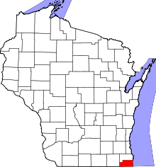 | |
| Villages | ||
| Towns | ||
| CDPs | ||
| Unincorporated communities | ||
| Ghost town/neighborhood | ||
| Footnotes | ‡This populated place also has portions in an adjacent county or counties | |
Coordinates: 42°38′25″N 87°54′37″W / 42.64028°N 87.91028°W