Slades Corners, Wisconsin
| Slades Corners, Wisconsin | |
|---|---|
| Unincorporated community | |
 Downtown Slades Corners from Wisconsin Highway 50 | |
 Slades Corners, Wisconsin  Slades Corners, Wisconsin | |
| Coordinates: 42°34′55″N 88°17′38″W / 42.58194°N 88.29389°WCoordinates: 42°34′55″N 88°17′38″W / 42.58194°N 88.29389°W | |
| Country | United States |
| State | Wisconsin |
| County | Kenosha |
| Elevation | 866 ft (264 m) |
| Time zone | UTC-6 (Central (CST)) |
| • Summer (DST) | UTC-5 (CDT) |
| Area code(s) | 262 |
| GNIS feature ID | 1574263[1] |
Slades Corners is a small unincorporated residential and agricultural community located on Old Highway 50 and 400th Avenue (Kenosha County Highway P, or Dyer Lake Road) in the southwestern Kenosha County, Wisconsin town of Wheatland.[2] Slades Corners is named for Tom Slade, an early resident who settled 640 acres (2.6 km2) there in approximately 1840, eight years before Wisconsin statehood.[3]
Notes
Municipalities and communities of Kenosha County, Wisconsin, United States | ||
|---|---|---|
| City | 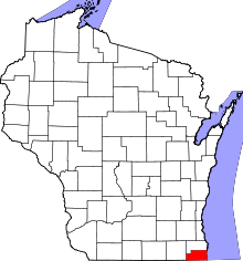 | |
| Villages | ||
| Towns | ||
| CDPs | ||
| Unincorporated communities | ||
| Ghost town/neighborhood | ||
| Footnotes | ‡This populated place also has portions in an adjacent county or counties | |
This article is issued from
Wikipedia.
The text is licensed under Creative Commons - Attribution - Sharealike.
Additional terms may apply for the media files.