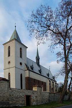
Slavětín (Louny District)
| Slavětín | ||
|---|---|---|
| Městys | ||
 | ||
| ||
 Slavětín | ||
| Coordinates: 50°21′2″N 13°54′27″E / 50.35056°N 13.90750°ECoordinates: 50°21′2″N 13°54′27″E / 50.35056°N 13.90750°E | ||
| Country |
| |
| Region | Ústí nad Labem | |
| District | Louny | |
| Area | ||
| • Total | 8.40 km2 (3.24 sq mi) | |
| Elevation | 230 m (750 ft) | |
| Population (2007) | ||
| • Total | 443 | |
| • Density | 53/km2 (140/sq mi) | |
| Postal code | 439 09 to 440 01 | |
| Website | http://www.slavetin.info | |
Slavětín is a small town (městys) in Louny District in the Ústí nad Labem Region of the Czech Republic.
The town covers an area of 8.40 square kilometres (3.24 sq mi), and has a population of 443 (as at 31 December 2007).
Slavětín lies approximately 8 kilometres (5 mi) east of Louny, 36 km (22 mi) south of Ústí nad Labem, and 47 km (29 mi) north-west of Prague.
References
| Wikimedia Commons has media related to Slavětín (Louny District). |
This article is issued from
Wikipedia.
The text is licensed under Creative Commons - Attribution - Sharealike.
Additional terms may apply for the media files.