Domoušice
| Domoušice | |
|---|---|
| Municipality | |
 | |
 Domoušice | |
| Coordinates: 50°14′0″N 13°43′1″E / 50.23333°N 13.71694°ECoordinates: 50°14′0″N 13°43′1″E / 50.23333°N 13.71694°E | |
| Country |
|
| Region | Ústí nad Labem |
| District | Louny |
| Area | |
| • Total | 15.27 km2 (5.90 sq mi) |
| Elevation | 415 m (1,362 ft) |
| Population (2016) | |
| • Total | 660 |
| • Density | 43/km2 (110/sq mi) |
| Postal code | 439 68 to 440 01 |
Domoušice (German: Domauschitz) is a village and municipality (obec) in Louny District in the Ústí nad Labem Region of the Czech Republic. The municipality covers an area of 15.35 square kilometres (5.93 sq mi), and has a population of 660 (as of 1 January 2016). The highest point si Pískový vrch (526 meters) and the lowest point is creek bed of Hasina (290 meters). Domoušice lies approximately 15 kilometres (9 mi) south-west of Louny, 53 km (33 mi) south-west of Ústí nad Labem, and 53 km (33 mi) west of Prague. The railway Rakovník-Most, 2 bus lines and a road 3rd class go thought Domoušice. There is a post office, a cinema, a kindergarten and a primary school.
Historical monuments
- Baroque Domoušice castle
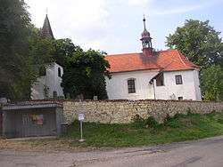
- St. Martin's Church
- Fort Domoušice
- cs:Kamenné řady Kounov - Prehistoric stone series
- Castle ruins of cs:Pravda (hrad)
Natives
- Josef J. Pihert (1845–1911), Czech music maker and teacher
- Ing. Václav Morch (1909–1979), Czech surveyor and cartographer
- Václav Bergman (1915–2003), fighter pilot, participant in the Battle of Britain, after a certain for commandant 313th Czechoslovak fighter Squadron RAF
Parts of Village
Domoušice
Gallery
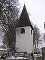 Belfry near the church
- St. Martin's Church
 House Catherine Johnson
 Castle
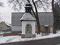 Bell tower with chapel
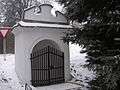 St. Jude Thaddeus Chapel
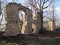 Castle ruins of Pravda
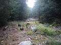 Kounovské kamenné řady
References
| Wikimedia Commons has media related to Domoušice. |
This article is issued from
Wikipedia.
The text is licensed under Creative Commons - Attribution - Sharealike.
Additional terms may apply for the media files.