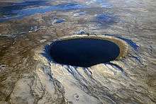
Sierra Madera crater
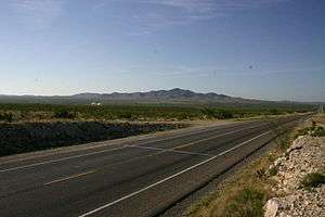 Sierra Madera viewed from US Hwy 385 | |
| Impact crater/structure | |
|---|---|
| Confidence | Confirmed[1] |
| Diameter | 8 mi (13 km) |
| Age | 100 million years |
| Exposed | Yes |
| Drilled | Yes |
| Location | |
| Location | Pecos County, West Texas |
| Coordinates | 30°36′N 102°55′W / 30.600°N 102.917°WCoordinates: 30°36′N 102°55′W / 30.600°N 102.917°W[2] |
| Country | United States |
 Sierra Madera Sierra Madera in Texas | |
| Topo map | Sierra Madera |
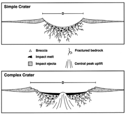
Sierra Madera crater is a meteorite crater (astrobleme) in southwestern Pecos County, Texas, United States.[1] The central peak of the rebound structure of the impact crater rises 793 ft (242 m) above the surrounding land.[3] The peak is visible from U.S. Highway 385 between Fort Stockton, Texas and Marathon, Texas. The Sierra Madera crater is located on private property on the La Escalera Ranch.
It is 13 km (8 mi) in diameter and the age is estimated to be less than 100 million years (Cretaceous or younger).[1]
Apollo 17's Gene Cernan and Jack Schmitt did some of their geologic training here.[4]
See also
References
- 1 2 3 "SierraMadera". Earth Impact Database. University of New Brunswick. Retrieved 2016-12-10.
- ↑ U.S. Geological Survey Geographic Names Information System: Sierra Madera
- ↑ Sierra Madera from the Handbook of Texas Online
- ↑ Phinney, William (2015). Science Training History of the Apollo Astronauts. NASA SP -2015-626. pp. 251–252.
External links
- Sierra Madera astrobleme, Center for Energy and Economic Diversification (CEED), University of Texas of the Permian Basin
- La Escalera Ranch - site of Sierra Madera crater
- Sierra Madera astrobleme, Sibley Nature Center, Midland, Texas
- Sierra Madera Meteor Crater photos by Phil Stuart
- Photos of West Texas and the Llano Estacado
This article is issued from
Wikipedia.
The text is licensed under Creative Commons - Attribution - Sharealike.
Additional terms may apply for the media files.