Shaqlawa
| Shaqlawa Kurdish: شەقڵاوە | |
|---|---|
.JPG) View from a Down town | |
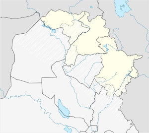 Shaqlawa Shaqlawa in Iraq 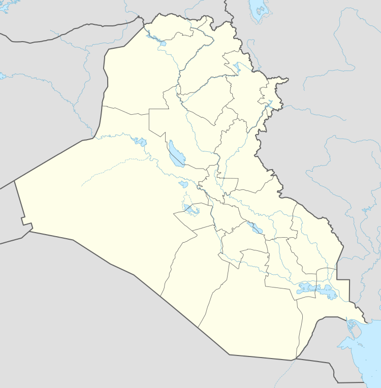 Shaqlawa Shaqlawa (Iraq) | |
| Coordinates: 36°24′20″N 44°19′15″E / 36.40556°N 44.32083°ECoordinates: 36°24′20″N 44°19′15″E / 36.40556°N 44.32083°E | |
| Country |
|
| Autonomous region |
|
| Province | Arbil Province |
| Government | |
| • Governor | Nawzad Hadi |
| Population | |
| • Total | 27,500 |
Shaqlawa (Kurdish: Şeqlawe , شەقڵاوە, Arabic: شقلاوة) is a historic city and a Hill station in the Erbil Governorate in the Kurdistan region of Iraq. Shaqlawa, a city of approximately 25,000 people, lies 51 km to the northeast of Erbil, at the bottom of Safeen Mountain. Shaqlawa is situated between Safeen Mountain and Sork Mountain, and sits 1066 m above sea level. The town is inhabited mostly by Kurds, with a small Assyrian minority.[2] Shaqlawa has a very large quantity of waterfalls, trees, and a great growing of greenery.[3]
Etymology
There is no mention of the town before the 12th century. It is referred to by Arab historians as Shaqlabad, Shaqlabund, Shaqabad, Shaqli.
Geography
The town lies at the foot of Mountain Safeen, which is covered by vast and dense forests, in a fertile and vast valley 50 km north of the Governorate of Erbil. To the east and north is the Sorek mountain.
Climate
Shaqlawa has a Mediterranean climate (Csa) with very hot summers and relatively cold, wet winters. Subfreezing highs are very common in the winter, which would present frost. Snowfall is not uncommon. Due to its relatively cooler summer weather, Shaqlawa is visited annually by thousands of tourists from other, hotter parts of Iraq.
| Climate data for Shaqlawa | |||||||||||||
|---|---|---|---|---|---|---|---|---|---|---|---|---|---|
| Month | Jan | Feb | Mar | Apr | May | Jun | Jul | Aug | Sep | Oct | Nov | Dec | Year |
| Average high °C (°F) | 9.1 (48.4) |
10.4 (50.7) |
14.5 (58.1) |
20.1 (68.2) |
27.5 (81.5) |
34.4 (93.9) |
38.6 (101.5) |
38.8 (101.8) |
35.0 (95) |
27.9 (82.2) |
17.8 (64) |
10.8 (51.4) |
23.7 (74.7) |
| Average low °C (°F) | −0.4 (31.3) |
0.4 (32.7) |
4.1 (39.4) |
8.8 (47.8) |
14.4 (57.9) |
19.7 (67.5) |
23.6 (74.5) |
23.3 (73.9) |
18.9 (66) |
13.1 (55.6) |
6.6 (43.9) |
1.4 (34.5) |
11.2 (52.1) |
| Average precipitation mm (inches) | 149 (5.87) |
202 (7.95) |
165 (6.5) |
111 (4.37) |
43 (1.69) |
0 (0) |
0 (0) |
0 (0) |
1 (0.04) |
10 (0.39) |
76 (2.99) |
124 (4.88) |
881 (34.68) |
| Source: [4] | |||||||||||||
Culture
Shaqlawa's citizens are Muslims and Christians, where both have been living together for more than a decade. Shaqlawa is mostly known for the grave of St. Boya, on the top of Shaqlawa's mountain. Assyrians from several Kurdish regions visit St. Boya's grave and enjoy Shaqlawa's beautiful weather. Established in 1965, Virgin Mary Church is an Assyrian church in the city. Shaqlawa attracts the tourists due to its nature. [5]
Facilities
The city has many public constructions, such as a kindergarten, a club for retirees, a guest house, Ishtar Local Centre, a large playground and a church office. One of the best facility in Shaqlawa is tourism, Hiran is approximately 23 kilometres away from Shaqlawa. Hiran has many visitors from various kinds of religions because it has beautiful weather and it contains food shops, souvenirs shops and the nuts shops.
References
- ↑ "Kurdistan Regional Government". KRG. Retrieved 2012-05-21.
- ↑ http://www.ishtartv.com/en/viewarticle,36256.html
- ↑ http://bot.gov.krd/erbil-province/shaqlawa
- ↑ "Climate statistics for Shaqlawa". Climate-Data. Retrieved 21 January 2017.
- ↑ http://bot.gov.krd/erbil-province/shaqlawa
| Wikimedia Commons has media related to Shaqlawa. |