Kalar, Iraq
| Kalar Kurdish: کهلار Kelar | |
|---|---|
 The view of Kalar from Sherwana Castle | |
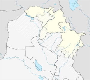 Kalar Kalar in Iraq 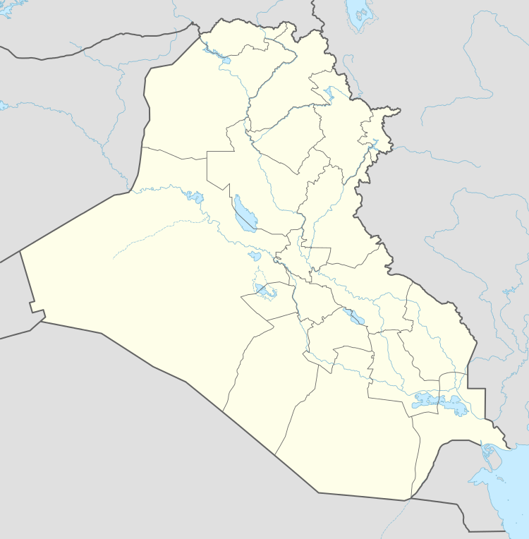 Kalar Kalar (Iraq) | |
| Coordinates: 34°37′45″N 45°19′20″E / 34.62917°N 45.32222°ECoordinates: 34°37′45″N 45°19′20″E / 34.62917°N 45.32222°E | |
| Country |
|
| Autonomous region |
|
| Governorate | Sulaymaniyah |
| District | Kalar |
| Elevation | 231 m (758 ft) |
| Population | |
| • Total | 210,000 (250,000 including Rizgari)[1] |
| Time zone | UTC+3 |
Kalar (Kurdish: کهلار, Kelar ) is a city in Iraq located on the west bank of the Sirwan (Diyala) river in Sulaymaniyah Governorate. It is located east of Kifri and west of the Kermanshah, Iran towns of Qasri Shirin and Sarpol Zahab. The city is one of the twin towns of Rizgari-Kalar. It is an expanding urban area with growing infrastructure and a booming economy, with properties often more expensive than those in advanced countries. It is divided into the neighborhoods of Salaxa, Grdegozina, Bardasoor, Hamay Karem, Shaheedan, Gazino and Kalari-Kon.
Geography
Kalar is a major city that lies between the upper Mesopotamian highlands of the Zagros and the lower Mesopotamian plains. Kalar's elevation is 231 meters above sea level (758 feet). It's located on the west bank of the Sirwan River which is a major tributary of the larger Tigris River and is the main source of agriculture in the region. The city has vast significance being located near the Qasr-e Shirin border crossing between Iraq and Iran and it's also at the border between the semi-autonomous kurdish homeland of Iraqi Kurdistan and Iraq. It's also located near the oil fields of Sarqala and Hasira. Kalar is also the 6th largest city in Iraqi Kurdistan, Larger than Halabja but smaller than Zakho.
History
The Garmian area experienced the 3rd stage of the genocidal Al-Anfal campaign. The neighboring town Smud was built as a relocation camp for Kurds. It was later renamed Rizgari (Liberation) for the 1991 Iraqi uprising.
Kalar is also home to the Sherwana Citadel which is located on an elevated region on the west bank of the Sirwan River. It's claimed to have been built by Mohamed Pasha Jaff in the 19th Century but it's true origins remain unknown. The Sherwana Citadel has been damaged on many occasions. Most recently in the 12th of November 2017 at 18:18 UTC a catastrophic magnitude 7.3 earthquake devastated the region and destroyed the top portion of the citadel.
Culture
Kalar hosts the University of Garmian, a satellite campus of University of Sulaymaniyah which specialises in agriculture. The University of Garmian is also the area's first scientific center to provide a Geographic Information Systems laboratory for post-graduate students.
The town also contains the Folkloric Museum of Garmian, with 400 artifacts from the region.
Climate
Kalar is located in the Garmiyan Region which is known for having a warm and dry climate which can occasionally reach over 50* Celsius in the Summer. It's warmest in July with an average temperature of (45-50*) Celsius and coldest in January with an average temperature of (10-15*) Celsius. The temperature rarely reaches below 0* Celsius in winter. According to the Köppen-Geiger climate classification system, Kalar has a Semi-arid climate (BSh).
| Climate data for Kalar, Iraq | |||||||||||||
|---|---|---|---|---|---|---|---|---|---|---|---|---|---|
| Month | Jan | Feb | Mar | Apr | May | Jun | Jul | Aug | Sep | Oct | Nov | Dec | Year |
| Record high °C (°F) | 25 (77) |
30 (86) |
37 (99) |
42 (108) |
49 (120) |
51 (124) |
53 (127) |
54 (129) |
52 (126) |
44 (111) |
33 (91) |
29 (84) |
54 (129) |
| Average high °C (°F) | 15 (59) |
17 (63) |
23 (73) |
30 (86) |
37 (99) |
44 (111) |
47 (117) |
47 (117) |
42 (108) |
34 (93) |
24 (75) |
17 (63) |
31 (89) |
| Average low °C (°F) | 3 (37) |
4 (39) |
9 (48) |
14 (57) |
20 (68) |
25 (77) |
29 (84) |
27 (81) |
21 (70) |
16 (61) |
10 (50) |
5 (41) |
15 (59) |
| Record low °C (°F) | −15 (5) |
−11 (12) |
−6 (21) |
0 (32) |
10 (50) |
15 (59) |
20 (68) |
15 (59) |
7 (45) |
1 (34) |
−4 (25) |
−13 (9) |
−15 (5) |
| Average rainfall mm (inches) | 34.1 (1.343) |
31.1 (1.224) |
40.3 (1.587) |
36 (1.42) |
15.5 (0.61) |
0 (0) |
0 (0) |
0 (0) |
0 (0) |
12.4 (0.488) |
27 (1.06) |
27.9 (1.098) |
224.3 (8.83) |
| Source: [2] | |||||||||||||
Notable inhabitants
References
- ↑ KALAR Residents. "Kalar | Unbelievable Kurdistan - Official Tourism Site of Kurdistan". bot.gov.krd.
- ↑ Kalar weather. "Kalar climate: Average Temperature, weather by month, Kalar weather averages - Climate-Data.org". en.climate-data.org.