Sgùrr a' Choire Ghlais
| Sgurr a' Choire Ghlais | |
|---|---|
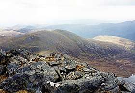
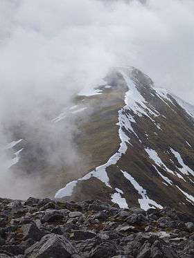 The north-east ridge | |
| Highest point | |
| Elevation | 1,083 m (3,553 ft) [1] |
| Prominence | 818 m (2,684 ft) Ranked 31st in British Isles |
| Parent peak | Sgurr na Lapaich |
| Listing | Munro, Marilyn |
| Naming | |
| Translation | Rocky Peak of the Grey Corrie (Gaelic) |
| Pronunciation |
Scottish Gaelic: [ˈs̪kuːrˠ ə ˈxɔɾʲə ˈɣl̪ˠaʃ] English approximation: SKOOR-ə-COR-yə-GLASH |
| Geography | |
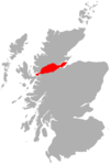
| Location | Glen Strathfarrar, Scotland |
| OS grid | NH259430 |
| Topo map | OS Landranger 25 |
Sgurr a' Choire Ghlais is a mountain in the North-west Highlands of Scotland. It lies between Glen Strathfarrar and Glen Orrin and it is an excellent viewpoint, being the highest mountain in its group - a group which includes the Munros of Sgurr na Ruaidhe, Sgurr Fhuar-thuill and Carn nan Gobhar. Northwards there is no higher ground apart from the Fannaichs.
It is one of the most difficult hills to reach in Scotland, the shortest route involving a 10-mile approach up Glen Strathfarrar. A bicycle, or permission to drive along the private road up Strathfarrar, may shorten the approach.
Footnotes
- ↑ "walkhighlands Sgurr a'Choire Ghlais". walkhighlands.co.uk. 2014. Retrieved 9 January 2014.
See also
| Wikimedia Commons has media related to Sgùrr a' Choire Ghlais. |
- List of mountains of the British Isles by relative height
- List of Munros
- List of Marilyns in the Northern Highlands
| Northern Highlands |    | |
|---|---|---|
| Western Highlands | ||
| Central and Eastern Highlands | ||
| Southern Highlands | ||
| Islands | ||
| Scottish Lowlands, England and Wales | ||
 |
|  | |
Coordinates: 57°26′38″N 4°54′10″W / 57.44383°N 4.90265°W
This article is issued from
Wikipedia.
The text is licensed under Creative Commons - Attribution - Sharealike.
Additional terms may apply for the media files.