Beinn Dearg (Ullapool)
| Beinn Dearg | |
|---|---|
 | |
| Highest point | |
| Elevation | 1,084 m (3,556 ft) [1] |
| Prominence | c. 810 m Ranked 34th in British Isles |
| Parent peak | Sgurr Mor |
| Listing | Munro, Marilyn |
| Naming | |
| Translation | Red mountain (Gaelic) |
| Pronunciation |
Scottish Gaelic: [ˈpeiɲ ˈtʲɛɾɛk] English approximation: bayn-DYERR-ek |
| Geography | |
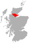
| Location | Wester Ross, Scotland |
| OS grid | NH259811 |
| Topo map | Ordnance Survey Landranger 20 |
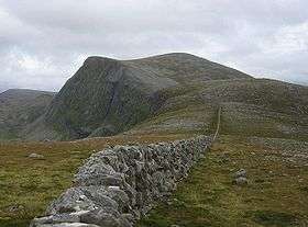
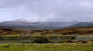
Beinn Dearg (one of a number of Scottish hills of that name) is a mountain in the Inverlael area of the Highlands of Scotland. It is most frequently climbed by following the River Lael up Gleann na Sguaib. Starting from near the head of Loch Broom, a path follows the glen to a bealach, which is about a kilometre north of the summit. From this bealach, the neighbouring peaks of Con a' Mheall and Meall na Ceapraichean may also be climbed. Eididh nan Clach Geala, which lies about 3 km north of Beinn Dearg, is also added in to complete a round of 4 Munros.
During early 2005, strong winds caused much damage to trees in the Inverlael Forest, almost completely blocking the route described.
Beinn Dearg is designated as a Special Protection Area. The area encompasses a diverse range of habitats, including woodland, mire, open water, dwarf-shrub heath, and cliffs. Most significantly, the summit areas support specialist montane birds such as breeding dotterel Charadrius morinellus and golden eagle Aquila chrysaetos.
Footnotes
- ↑ "walkhighlands Beinn Dearg (Ullapool)". walkhighlands.co.uk. 2014. Retrieved 1 March 2014.
External links
| Northern Highlands | 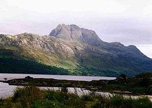   | |
|---|---|---|
| Western Highlands | ||
| Central and Eastern Highlands | ||
| Southern Highlands | ||
| Islands | ||
| Scottish Lowlands, England and Wales | ||
 |
|  | |