Seto, Aichi
| Seto 瀬戸市 | |||
|---|---|---|---|
| City | |||
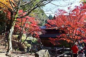 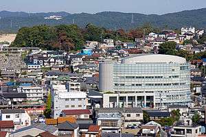 Upper stage:Jōkō-ji temple in Seto Lower stage:Seto Skyline | |||
| |||
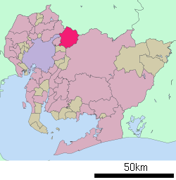 Location of Seto in Aichi Prefecture | |||
 Seto | |||
| Coordinates: 35°13′24.9″N 137°05′3.1″E / 35.223583°N 137.084194°ECoordinates: 35°13′24.9″N 137°05′3.1″E / 35.223583°N 137.084194°E | |||
| Country | Japan | ||
| Region | Chūbu (Tōkai) | ||
| Prefecture | Aichi Prefecture | ||
| Government | |||
| • Mayor | Yasunori Ito | ||
| Area | |||
| • Total | 111.40 km2 (43.01 sq mi) | ||
| Population (May 2015) | |||
| • Total | 129,976 | ||
| • Density | 1,170/km2 (3,000/sq mi) | ||
| Time zone | UTC+9 (Japan Standard Time) | ||
| Official tree | Ilex rotunda | ||
| Official flower | Camellia | ||
| Phone number | 0561-82-7111 | ||
| Address | 64-1 Oiwake-chō, Seto-shi, Aichi-ken 489-8701 | ||
| Website | Official website | ||

Seto (瀬戸市 Seto-shi) is a city located in Aichi Prefecture, Japan.
As of May 2015, the city had an estimated population of 129,976 and a population density of 1,170 persons per km². The total area was 111.61 square kilometres (43.09 sq mi). It is located about 35 minutes from Nagoya by way of the Meitetsu Seto Line.
Geography
Seto is located in the hilly northern region of Aichi Prefecture, bordering Gifu Prefecture. In English, the name of Seto translates to "the place where the river runs quickly." However, while there is a river in Seto, it is neither significantly large nor quick-moving. The city of Seto is famous for its pottery and ceramics, so much so that the generic word for ceramics in Japanese is setomono (瀬戸物 setomono). The main street along the river is lined with dozens of pottery shops. Every third Saturday and Sunday in September, there is a very large pottery festival called Setomono Matsuri [1](瀬戸物祭り) This festival attracts about 20,000 visitors from around Japan and abroad every year.
Surrounding municipalities
Aichi Prefecture
Gifu Prefecture
History
During the Edo period, the area of modern Seto was controlled by the Owari Tokugawa of Nagoya. The area had been famous for its ceramics production since at least the Kamakura period. During the Meiji period, Seto village was organized in 1888, becoming a town in 1892. After annexing the neighboring village of Akatsu in 1925, Seto was raised to city status on October 1, 1929. Much of the city was destroyed in 1945 during World War II.[2]
In the postwar period, the city grew as a bedroom community for Nagoya and as a tourist designation. On March 25, 2005, Expo 2005 opened with its main site being in Nagakute and additional activity in Seto. The expo continued until September 25, 2005.
Transportation
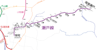
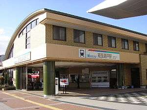
Railways
Expressways
Japan National Route
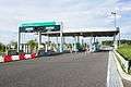 Seto-Akazu Interchange
.jpg)
Education
- University
- Nanzan University – Seto campus
- Nagoya Gakuin University – Seto campus
- Nagoya Seirei Junior College
- School
- Seto has 20 elementary schools, nine middle schools, and six high schools. It also has two special education schools
- International School
- Aichi Korean 7th Elementary School (愛知朝鮮第七初級学校) - North Korean school[3]
Sister city relations
.svg.png)


Local attractions
- Aichi Prefectural Ceramic Museum
- Setogura Museum
- Jōkō-ji Buddhist temple and mausoleum of Lord Tokugawa Yoshinao of the Owari Domain.
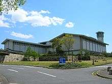 Aichi Prefectural Ceramic Museum
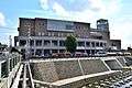 Setogura Museum
 Setomono Festival
 Unkō-ji
 Jōkō-ji
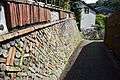 Kamagaki no Komichi
 Hongyō kiln
Notable people from Seto
- Sayaka Aoki – comedian
- Junji Suzuki – politician
- Asaka Seto – actress
- Manpei Takagi – actor
- Toru Hasegawa – professional soccer player
- Hayata Ito – professional baseball player
- Sōta Fujii - professional shogi player
References
- ↑ Seto homestay programme
- ↑ Seto official home page
- ↑ Home page. Aichi Korean 7th Elementary School. Retrieved on October 14, 2015. "愛知県瀬戸市にある在日コリアン児童が通う民族学校です"
- 1 2 3 4 "International Exchange". List of Affiliation Partners within Prefectures. Council of Local Authorities for International Relations (CLAIR). Archived from the original on 24 December 2015. Retrieved 21 November 2015.
External links
| Wikimedia Commons has media related to Seto, Aichi. |

- Official website (in Japanese)
| Wards of Nagoya | ||
|---|---|---|
| Core cities | ||
| Special cities | ||
| Cities | ||
| Districts | ||
| Law Enforcement | ||