Kōnan, Aichi
| Kōnan 江南市 | |||
|---|---|---|---|
| City | |||
 Hotei Daibutsu in Konan City | |||
| |||
 Location of Kōnan in Aichi Prefecture | |||
 Kōnan | |||
| Coordinates: 35°19′55.5″N 136°52′14.4″E / 35.332083°N 136.870667°ECoordinates: 35°19′55.5″N 136°52′14.4″E / 35.332083°N 136.870667°E | |||
| Country | Japan | ||
| Region | Chūbu (Tōkai) | ||
| Prefecture | Aichi Prefecture | ||
| Government | |||
| Area | |||
| • Total | 30.20 km2 (11.66 sq mi) | ||
| Population (May 2015) | |||
| • Total | 99,005 | ||
| • Density | 3,280/km2 (8,500/sq mi) | ||
| Time zone | UTC+9 (Japan Standard Time) | ||
| - Tree | Round Leaf Holly | ||
| - Flower | Wisteria | ||
| Phone number | 0587-54-1111 | ||
| Address | 90 Ōbori, Akadouji-machi, Kōnan-shi, Aichi-ken 483-8701 | ||
| Website | Official website | ||


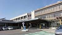
Kōnan city hall
.jpg)
Hotei Town
Kōnan (江南市 Kōnan-shi) is a city located in Aichi Prefecture, Japan.
As of May 2015, the city had an estimated population of 99,005 and a population density of 3,280 persons per km². The total area was 30.20 square kilometres (11.66 sq mi).
Geography
Kōnan is located in the far northwest corner of Aichi Prefecture, bordering on Gifu Prefecture. Its name means "south of the river", referring to the Kiso River.
Surrounding municipalities
- Aichi Prefecture
- Gifu Prefecture
History
Kōnan was created on June 1, 1954 through the merger of the former towns of Kochino and Hotei (both from Niwa District), with the former town of Miyata, and the former village of Kusai (both from Haguri District).
Education
- Aichi Konan College
- Kōnan has ten elementary schools, six middle schools and four high schools
Transportation

Railways
Highways
Local attractions
- Park
- Flower Park Konan
- Suitopia Konan
 Flower Park Konan
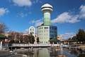 Suitopia Konan
- Festival
_-_panoramio.jpg) Kitano Tenjin Festival
Kitano Tenjin Festival
Notable people from Kōnan
- Yukari Nakano – figure skater
External links
![]()
- Official website (in Japanese)
| Wards of Nagoya | ||
|---|---|---|
| Core cities | ||
| Special cities | ||
| Cities | ||
| Districts | ||
| Law Enforcement | ||
This article is issued from
Wikipedia.
The text is licensed under Creative Commons - Attribution - Sharealike.
Additional terms may apply for the media files.