Seri, Mugu
| Seri सेरी | |
|---|---|
| Village Development Committee | |
 Seri Location in Nepal | |
| Coordinates: 29°31′0″N 81°58′0″E / 29.51667°N 81.96667°ECoordinates: 29°31′0″N 81°58′0″E / 29.51667°N 81.96667°E | |
| Country |
|
| Zone | Karnali Zone |
| District | Mugu District |
| Population (1991) | |
| • Total | 1,464 |
| Time zone | UTC+5:45 (Nepal Time) |
Seri (Nepali: सरी) is a Village Development Committee in Mugu District in the Karnali Zone of north-western Nepal. At the time of the 2012 Nepal census it had a population of 2307 people residing in 384 individual households.[1]
References
- ↑ "Nepal Census 2001". Nepal's Village Development Committees. Digital Himalaya. Retrieved November 4, 2008.
External links
Headquarters: Gamgadhi (today part of Chhayanath Rara Municipality) | ||
| Municipalities | 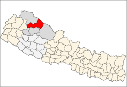 | |
| Rural municipalities |
| |
| Former VDCs | ||
List of municipalities and rural municipalities of Nepal | ||
This article is issued from
Wikipedia.
The text is licensed under Creative Commons - Attribution - Sharealike.
Additional terms may apply for the media files.