Mugu, Nepal
| Mugu मुगु | |
|---|---|
| Village development committee | |
 Mugu Location in Nepal | |
| Coordinates: 29°52′0″N 82°37′0″E / 29.86667°N 82.61667°ECoordinates: 29°52′0″N 82°37′0″E / 29.86667°N 82.61667°E | |
| Country |
|
| Zone | Karnali Zone |
| District | Mugu District |
| Population (1991) | |
| • Total | 898 |
| Time zone | UTC+5:45 (Nepal Time) |
Mugu is a village development committee in the Himalayas of Mugu District in the Karnali Zone of north-western Nepal. After Dolphu it is the second largest VDC in Mugu District which takes its name from it. It is located on the border with Tibet, China. At the time of the 1991 Nepal census it had a population of 898 people living in 181 individual households.[1]
References
- ↑ "Nepal Census 2001". Nepal's Village Development Committees. Digital Himalaya. Retrieved 4 November 2008.
External links
Headquarters: Gamgadhi (today part of Chhayanath Rara Municipality) | ||
| Municipalities | 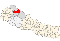 | |
| Rural municipalities |
| |
| Former VDCs | ||
List of municipalities and rural municipalities of Nepal | ||
This article is issued from
Wikipedia.
The text is licensed under Creative Commons - Attribution - Sharealike.
Additional terms may apply for the media files.