Sedalia, Kentucky
| Sedalia, Kentucky | |
|---|---|
| Census-designated place | |
 Sedalia  Sedalia | |
| Coordinates: 36°38′35″N 88°36′13″W / 36.64306°N 88.60361°WCoordinates: 36°38′35″N 88°36′13″W / 36.64306°N 88.60361°W | |
| Country |
|
| State |
|
| County | Graves |
| Area | |
| • Total | 3.08 km2 (1.19 sq mi) |
| • Land | 3.07 km2 (1.19 sq mi) |
| • Water | 0.01 km2 (0.004 sq mi) |
| Elevation | 153 m (502 ft) |
| Population (2010) | |
| • Total | 295 |
| • Density | 96.2/km2 (249/sq mi) |
| Time zone | UTC-6 (Central (CST)) |
| • Summer (DST) | UTC-5 (CDT) |
| ZIP Code | 42079 |
| Area code(s) | 270 & 364 |
| GNIS feature ID | 2629678 |
| U.S. Geological Survey Geographic Names Information System: Sedalia, Kentucky | |
Sedalia is an unincorporated community and census-designated place (CDP) in Graves County, Kentucky, United States.[1] As of the 2010 census the population was 295.[2]
Sedalia is located 7 miles (11 km) south of Mayfield, the Graves County seat.
References
- ↑ "Feature Detail Report for: Sedalia, Kentucky." USGS. U.S. Geological Survey Geographic Names Information System: Sedalia, Kentucky Retrieved May 11, 2011.
- ↑ "Geographic Identifiers: 2010 Demographic Profile Data (G001): Sedalia CDP, Kentucky". American Factfinder. U.S. Census Bureau. Retrieved December 12, 2016.
Municipalities and communities of Graves County, Kentucky, United States | ||
|---|---|---|
| Cities | 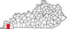 | |
| CDPs | ||
| Unincorporated communities | ||
| Footnotes | ‡This populated place also has portions in an adjacent county or counties | |
This article is issued from
Wikipedia.
The text is licensed under Creative Commons - Attribution - Sharealike.
Additional terms may apply for the media files.