Dogwood, Graves County, Kentucky
| Dogwood, Graves County, Kentucky | |
|---|---|
| Unincorporated community | |
 Dogwood  Dogwood | |
| Coordinates: 36°53′03″N 88°34′33″W / 36.88417°N 88.57583°WCoordinates: 36°53′03″N 88°34′33″W / 36.88417°N 88.57583°W | |
| Country | United States |
| State | Kentucky |
| County | Graves |
| Elevation | 381 ft (116 m) |
| Time zone | UTC-6 (Central (CST)) |
| • Summer (DST) | UTC-5 (CDT) |
Dogwood is an unincorporated community in Graves County, Kentucky, United States.
References
- "Dogwood, Kentucky". Geographic Names Information System. United States Geological Survey. Retrieved 2012-06-13.
Municipalities and communities of Graves County, Kentucky, United States | ||
|---|---|---|
| Cities | 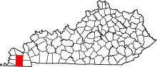 | |
| CDPs | ||
| Unincorporated communities | ||
| Footnotes | ‡This populated place also has portions in an adjacent county or counties | |
This article is issued from
Wikipedia.
The text is licensed under Creative Commons - Attribution - Sharealike.
Additional terms may apply for the media files.