Levakant
| Levakant Левакант | |
|---|---|
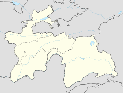 Levakant Location in Tajikistan | |
| Coordinates: 37°52′N 68°55′E / 37.867°N 68.917°E | |
| Country |
|
| Province | Khatlon |
| Elevation | 672 m (2,205 ft) |
| Population (2007) | |
| • Total | 12,800 |
Levakant (Tajik: Левакант), Kalininabad (Калилининобод) until February 1996, Sarband (Сарбанд) until January 2018[1], is a city in south-west Tajikistan. It is the administrative capital of Sarband district in Khatlon Province, located just east of the provincial capital Bokhtar and about 120 km south of the national capital Dushanbe.[2] The Golovnaya Dam on the Vakhsh River lies directly to its east.
The population of Sarband in 2007 was estimated to be at 12,800.[3]
Sarband is home to Tajikistan's only fertilizer manufacturing plant, Tajik Azot.
Climate
| Climate data for Sarband | |||||||||||||
|---|---|---|---|---|---|---|---|---|---|---|---|---|---|
| Month | Jan | Feb | Mar | Apr | May | Jun | Jul | Aug | Sep | Oct | Nov | Dec | Year |
| Average high °C (°F) | 7.9 (46.2) |
11.0 (51.8) |
16.7 (62.1) |
23.8 (74.8) |
29.4 (84.9) |
35.4 (95.7) |
37.1 (98.8) |
35.5 (95.9) |
31.0 (87.8) |
24.6 (76.3) |
16.9 (62.4) |
10.5 (50.9) |
23.3 (74) |
| Average low °C (°F) | −1.1 (30) |
1.0 (33.8) |
5.9 (42.6) |
11.3 (52.3) |
15.1 (59.2) |
18.6 (65.5) |
20.1 (68.2) |
18.1 (64.6) |
13.1 (55.6) |
8.6 (47.5) |
3.9 (39) |
0.9 (33.6) |
9.6 (49.3) |
| Average precipitation mm (inches) | 43 (1.69) |
52 (2.05) |
77 (3.03) |
55 (2.17) |
35 (1.38) |
3 (0.12) |
0 (0) |
0 (0) |
0 (0) |
14 (0.55) |
26 (1.02) |
39 (1.54) |
344 (13.54) |
| Source: Climate-data.org | |||||||||||||
See also
References
- ↑ Renaming of a number of cities, districts and settlements of Khatlon Province
- ↑ Republic of Tajikistan, map showing administrative division as of January 1, 2004, "Tojikkoinot" Cartographic Press, Dushanbe
- ↑ Population of the Republic of Tajikistan as of 1 January 2008, State Committee of Statistics, Dushanbe, 2008 (in Russian)
Coordinates: 37°52′0″N 68°55′0″E / 37.86667°N 68.91667°E
| Capital | 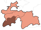 | |
|---|---|---|
| Districts | ||
| Main cities and towns | ||
This article is issued from
Wikipedia.
The text is licensed under Creative Commons - Attribution - Sharealike.
Additional terms may apply for the media files.