Kulob District
| Shuro-obod District Ноҳияи Кӯлоб ناحیه کــولاب | |
|---|---|
 | |
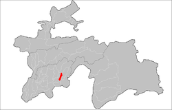 | |
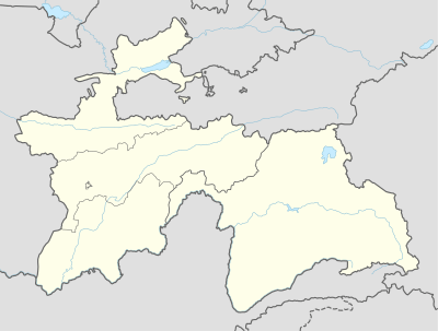 Shuro-obod District Ноҳияи Кӯлоб Kulob District Location in Tajikistan | |
| Coordinates: 37°54′43″N 69°46′51″E / 37.91194°N 69.78083°ECoordinates: 37°54′43″N 69°46′51″E / 37.91194°N 69.78083°E | |
| Country |
|
| Province | Khatlon |
| Capital | Kulob |
| Area | |
| • Land | 272,9 km2 (1,054 sq mi) |
| Population (2009) | |
| • Total | 89 400 |
| • Ethnicities |
|
| • Languages | Tajik-Persian |
| Time zone | UTC+5 |
| Area code(s) | +992,3322 |
| Website | tj |
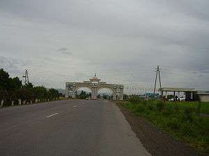
Kulob District or Nohiya-i Kulob (Tajik: Ноҳияи Кӯлоб, Nohiya‘i Kûlob/Nohijaji Kūloв) is a district in Khatlon province, Tajikistan. Its capital is Kulob. The city was founded in 691 BCE.
On 10 September 2006 Kulob City celebrated its 2700th anniversary. Thousands participated in this time, even foreigners.
Administrative divisions
The district is divided administratively into jamoats. They are as follows (and population).[1]
| Jamoats of Kulob District | |
| Jamoat | Population |
|---|---|
| Dahana | 21320 |
| Kulob | 11969 |
| Zarbdor | 16240 |
| Ziraki | 21522 |
Notes
- ↑ "List of Jamoats". UN Coordination, Tajikistan. Archived from the original on July 16, 2011. Retrieved April 4, 2009.
External links
- "Map of Khatlon Province showing Kulob District" (PDF) (in Russian).
| Capital | 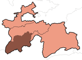 | |
|---|---|---|
| Districts | ||
| Main cities and towns | ||
This article is issued from
Wikipedia.
The text is licensed under Creative Commons - Attribution - Sharealike.
Additional terms may apply for the media files.