Saping
| Saping सापिङ | |
|---|---|
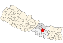
| Ward # 1 of Bhumlu Gaupalika | |
 Saping Location in Nepal | |
| Coordinates: 27°40′N 85°45′E / 27.66°N 85.75°ECoordinates: 27°40′N 85°45′E / 27.66°N 85.75°E | |
| Country | Nepal |
| Province | Province No. 3 |
| District | Kabhrepalanchok District |
| Population (2011) | |
| • Total | 3,246 |
| Time zone | UTC+5:45 (Nepal Time) |
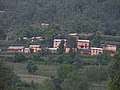
Saping is a sparsely populated village in Kabhrepalanchok district, about 60 kilometres east of Kathmandu, Nepal. As of 2011 census, Saping village has 786 households with 3246 individuals, 1,472 males and 1,774 females (CBS Nepal 2012), and under the "new" federal structure, formed by a new constitution, adopted on 20 September 2015, Saping is now a part of Bhumlu Gaupalika (in English: Bhumlu Rural Municipality) and is organized as Ward Number 1 (out of 10 small units called 'wards', cf. pre-2015 unit called Saping Village Development Committee[1]).
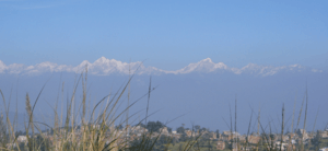
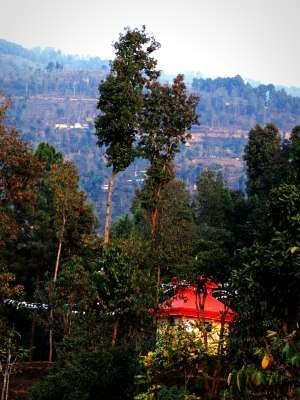
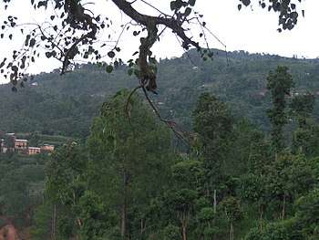
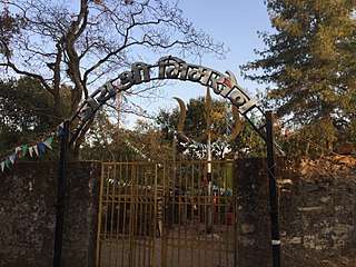
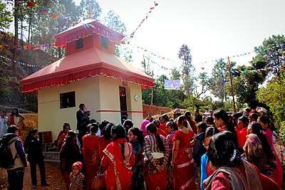
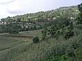
As a mixed ethnic and linguistic community, Saping has several well known travel destinations, including holy sites like Mulkharka Bhimsenthan and Saping Siddhi Ganesh Temple - both of which can be reached using vehicles or on foot from Dolalghat, as a part of a (day or two) trekking adventure.[2][3] In terms of geography, Saping consists largely of a rough hill terrain, with a few patches of semi-flat land here and there; its height ranges from 633 meters at Dolalghat Sukhoshi river, 1366 meters at Saping Siddhi Ganesh Temple (Ramche), to 1805 meters at Mulkharka Bhimsenthan. Because of its rugged landscape and varied altitude, the climate system also varies in Saping, from subtropical jungle along the Sunkoshi river banks to temparate forest around Mulkharka Bhimsenthan. The main source of income in Saping is agriculture, but in the recent years, the vast majority of young people have migrated to the cities, and foreign countries, especially to Arab countries in the Middle East, and Malaysia. As such, the remittances sent through foreign labour has become the primary source of livelihood for virtually all families.
In Saping village, the basic infrastructure such as road, electricity, water supply, etc. is still in a primitive state. Even though there is a newly opened ruggy track from Silame Bhir (just above Sunkoshi river banks at Dolaghat), it is not yet clear how far this road network will be developed and whether it will be linked to other long routes in the surrounding districts of Sindhupalchok, Dolakha, Ramechhap, etc.
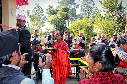
Electricity has reached the villagers but it is yet to be supplied using concrete poles, making it last for generations. Especially after the devastating earthquakes of 2015, water supply has become one of the major concerns because many of the natural spring water sources have disappeared. Furthermore, there is still no health post nor a police booth in the village. However, Sapingeli are becoming more hopeful than before because the first elected government (in 2018), under the Federal System, has tried to allocate a sizable annual budget to develop rural infrastructure.
References
- ↑ "Nepal Census 2001". Nepal's Village Development Committees. Digital Himalaya. Retrieved 2008-09-03.
- ↑ "Saping Siddhi Ganesh Temple". sapingsiddhiganeshtemple.blogspot.nl. Retrieved 2018-04-26.
- ↑ "Saping Tourism". Saping Siddhi Ganesh Temple. Ramche Saping 1. Retrieved 2018-02-16.
External links


Ministry of Federal Affairs and Local Development