Santo Tomas, Isabela
| Santo Tomas | ||
|---|---|---|
| Municipality | ||
| Municipality of Santo Tomas | ||
| ||
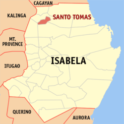 Map of Isabela with Santo Tomas highlighted | ||
.svg.png) Santo Tomas Location within the Philippines | ||
| Coordinates: 17°24′N 121°46′E / 17.4°N 121.77°ECoordinates: 17°24′N 121°46′E / 17.4°N 121.77°E | ||
| Country |
| |
| Region | Cagayan Valley (Region II) | |
| Province | Isabela | |
| District | 1st District of Isabela | |
| Founded | 1855 | |
| Barangays | 27 (see Barangays) | |
| Government [1] | ||
| • Type | Sangguniang Bayan | |
| • Mayor | Antonio Talaue | |
| • Vice Mayor | Leandro Antonio P. Talaue | |
| • Electorate | 14,475 voters (2016) | |
| Area [2] | ||
| • Total | 60.70 km2 (23.44 sq mi) | |
| Population (2015 census)[3] | ||
| • Total | 23,005 | |
| • Density | 380/km2 (980/sq mi) | |
| Time zone | UTC+8 (PST) | |
| ZIP code | 3327 | |
| PSGC | 023136000 | |
| IDD : area code | +63 (0)78 | |
| Climate type | Tropical rainforest climate | |
| Income class | 4th municipal income class | |
| Revenue (₱) | 73,487,133.85 (2016) | |
| Poverty incidence | 23.38 (2012)[4] | |
| Native languages |
Ilocano Tagalog | |

Santo Tomas, (Ibanag: Ili nat Santo Tomas; Ilokano: Ili ti Santo Tomas; Filipino: Bayan ng Santo Tomas), officially the Municipality of Santo Tomas, is a 4th class municipality in the province of Isabela, Philippines. According to the 2015 census, it has a population of 23,005 people.[3]
In 1952, Santo Tomas lost 2 barrios when the barrios of Abut and Minagbag were transferred to the newly created town of Mallig.[5] In 1961, those barrios were transferred to the newly created municipality of Quezon[6]
Barangays
Santo Tomas is politically subdivided into 27 barangays. [2]
- Ammugauan
- Antagan
- Bagabag
- Bagutari
- Balelleng
- Barumbong
- Biga Occidental
- Biga Oriental
- Bubug
- Bolinao-Culalabo
- Calanigan Norte
- Calanigan Sur
- Calinaoan Centro
- Calinaoan Malasin
- Calinaoan Norte
- Cañogan Abajo Norte
- Cañogan Abajo Sur
- Cañogan Alto
- Centro
- Colunguan
- Malapagay
- San Rafael Abajo
- San Rafael Alto
- San Roque
- San Vicente
- Uauang-Tuliao
- Uauang-Galicia
Demographics
| Population census of Santo Tomas | ||
|---|---|---|
| Year | Pop. | ±% p.a. |
| 1903 | 3,678 | — |
| 1960 | 11,460 | +2.01% |
| 1970 | 13,575 | +1.71% |
| 1975 | 14,239 | +0.96% |
| 1980 | 15,915 | +2.25% |
| 1990 | 18,063 | +1.27% |
| 1995 | 20,089 | +2.01% |
| 2000 | 21,380 | +1.34% |
| 2007 | 22,172 | +0.50% |
| 2010 | 21,688 | −0.80% |
| 2015 | 23,005 | +1.13% |
| Source: Philippine Statistics Authority[3][7][8][9] | ||
In the 2015 census, the population of Santo Tomas, Isabela, was 23,005 people,[3] with a density of 380 inhabitants per square kilometre or 980 inhabitants per square mile.
Climate
| Climate data for Santo Tomas, Isabela | |||||||||||||
|---|---|---|---|---|---|---|---|---|---|---|---|---|---|
| Month | Jan | Feb | Mar | Apr | May | Jun | Jul | Aug | Sep | Oct | Nov | Dec | Year |
| Average high °C (°F) | 29 (84) |
30 (86) |
32 (90) |
35 (95) |
35 (95) |
35 (95) |
34 (93) |
33 (91) |
32 (90) |
31 (88) |
30 (86) |
28 (82) |
32 (90) |
| Average low °C (°F) | 19 (66) |
20 (68) |
21 (70) |
23 (73) |
23 (73) |
24 (75) |
23 (73) |
23 (73) |
23 (73) |
22 (72) |
21 (70) |
20 (68) |
22 (71) |
| Average precipitation mm (inches) | 31.2 (1.228) |
23 (0.91) |
27.7 (1.091) |
28.1 (1.106) |
113.5 (4.469) |
141.4 (5.567) |
176.4 (6.945) |
236.6 (9.315) |
224.9 (8.854) |
247.7 (9.752) |
222.9 (8.776) |
178 (7.01) |
1,651.4 (65.023) |
| Average rainy days | 10 | 6 | 5 | 5 | 13 | 12 | 15 | 15 | 15 | 17 | 16 | 15 | 144 |
| Source: World Weather Online[10] | |||||||||||||
Economy
Farming is its primary source of income. The most widespread plantations were rice, corn and tobacco farms. Locals also raise livestock for extra income.
References
- ↑ "Municipality". Quezon City, Philippines: Department of the Interior and Local Government. Retrieved 31 May 2013.
- 1 2 "Province: Isabela". PSGC Interactive. Quezon City, Philippines: Philippine Statistics Authority. Retrieved 12 November 2016.
- 1 2 3 4 Census of Population (2015). "Region II (Cagayan Valley)". Total Population by Province, City, Municipality and Barangay. PSA. Retrieved 20 June 2016.
- ↑ "PSA Releases the 2012 Municipal and City Level Poverty Estimates". Quezon City, Philippines: Philippine Statistics Authority. Archived from the original on 28 January 2017. Retrieved 28 January 2017.
- ↑ "An Act Creating the Municipality of Mallig in the Province of Isabela". LawPH.com. Retrieved 2011-04-09.
- ↑ "An Act Creating the Municipality of Quezon in the Province of Isabela". LawPH.com. Retrieved 2014-12-06.
- ↑ Census of Population and Housing (2010). "Region II (Cagayan Valley)". Total Population by Province, City, Municipality and Barangay. NSO. Retrieved 29 June 2016.
- ↑ Censuses of Population (1903–2007). "Region II (Cagayan Valley)". Table 1. Population Enumerated in Various Censuses by Province/Highly Urbanized City: 1903 to 2007. NSO.
- ↑ "Province of Isabela". Municipality Population Data. Local Water Utilities Administration Research Division. Retrieved 17 December 2016.
- ↑ "Santo Tomas, Isabela: Average Temperatures and Rainfall". World Weather Online. Retrieved 31 October 2015.
External links
- Municipal Profile at the National Competitiveness Council of the Philippines
- Santo Tomas at the Isabela Government Website
- Local Governance Performance Management System
- Philippine Standard Geographic Code
- Philippine Census Information
- Municipality of Santo Tomas
Places adjacent to Santo Tomas, Isabela | ||||||||||
|---|---|---|---|---|---|---|---|---|---|---|
| ||||||||||
Ilagan (capital) | |
| Municipalities |
|
| Component Cities | |
| Independent Component City |
|
| Barangays | |