San Manuel, Isabela
| San Manuel | ||
|---|---|---|
| Municipality | ||
| Municipality of San Manuel | ||
| ||
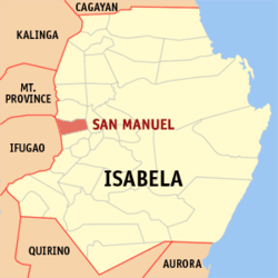 Map of Isabela with San Manuel highlighted | ||
.svg.png) San Manuel Location within the Philippines | ||
| Coordinates: 17°01′N 121°38′E / 17.02°N 121.63°ECoordinates: 17°01′N 121°38′E / 17.02°N 121.63°E | ||
| Country |
| |
| Region | Cagayan Valley (Region II) | |
| Province | Isabela | |
| District | 5th District of Isabela | |
| Founded | 1957 | |
| Barangays | 19 (see Barangays) | |
| Government [1] | ||
| • Type | Sangguniang Bayan | |
| • Mayor | Faustino "Mike" Dy III | |
| • Vice Mayor | Gloria Velasco | |
| • Electorate | 18,727 voters (2016) | |
| Area [2] | ||
| • Total | 112.77 km2 (43.54 sq mi) | |
| Population (2015 census)[3] | ||
| • Total | 31,896 | |
| • Density | 280/km2 (730/sq mi) | |
| Time zone | UTC+8 (PST) | |
| ZIP code | 3317 | |
| PSGC | 023130000 | |
| IDD : area code | +63 (0)78 | |
| Climate type | Tropical rainforest climate | |
| Income class | 4th municipal income class | |
| Revenue (₱) | 87,744,180.96 (2016) | |
| Poverty incidence | 16.15 (2012)[4] | |
| Native languages |
Ilocano Tagalog | |
| Website |
www | |

San Manuel (formerly Callang), officially the Municipality of San Manuel, is a 4th class municipality in the province of Isabela, Philippines. According to the 2015 census, it has a population of 31,896 people.[3]
The major industry in San Manuel is farming.
History
In 1957, the barrios of Callang, Eden, Babanuang, Cabaritan, Sta. Cruz, Malalinta, Mararigue, Calaocan, and Caraniogan of Roxas were separated to form Callang.[5] In 1965 the town was renamed as San Manuel.[6]
Barangays
Demographics
| Population census of San Manuel | ||
|---|---|---|
| Year | Pop. | ±% p.a. |
| 1960 | 6,525 | — |
| 1970 | 11,309 | +5.65% |
| 1975 | 14,535 | +5.16% |
| 1980 | 17,968 | +4.33% |
| 1990 | 24,620 | +3.20% |
| 1995 | 25,527 | +0.68% |
| 2000 | 27,059 | +1.26% |
| 2007 | 28,420 | +0.68% |
| 2010 | 30,407 | +2.49% |
| 2015 | 31,896 | +0.91% |
| Source: Philippine Statistics Authority[3][7][8][9] | ||
In the 2015 census, the population of San Manuel, Isabela, was 31,896 people,[3] with a density of 280 inhabitants per square kilometre or 730 inhabitants per square mile.
Climate
| Climate data for Roxas, Isabela | |||||||||||||
|---|---|---|---|---|---|---|---|---|---|---|---|---|---|
| Month | Jan | Feb | Mar | Apr | May | Jun | Jul | Aug | Sep | Oct | Nov | Dec | Year |
| Average high °C (°F) | 31 (88) |
31 (88) |
32 (90) |
34 (93) |
35 (95) |
34 (93) |
32 (90) |
32 (90) |
32 (90) |
32 (90) |
32 (90) |
31 (88) |
32 (90) |
| Average low °C (°F) | 22 (72) |
22 (72) |
22 (72) |
24 (75) |
24 (75) |
24 (75) |
24 (75) |
24 (75) |
24 (75) |
23 (73) |
23 (73) |
22 (72) |
23 (74) |
| Average precipitation mm (inches) | 13.6 (0.535) |
10.4 (0.409) |
18.2 (0.717) |
15.7 (0.618) |
178.4 (7.024) |
227.9 (8.972) |
368 (14.49) |
306.6 (12.071) |
310.6 (12.228) |
215.7 (8.492) |
70.3 (2.768) |
31.1 (1.224) |
1,766.5 (69.548) |
| Average rainy days | 3 | 2 | 2 | 4 | 14 | 16 | 23 | 21 | 24 | 15 | 10 | 6 | 140 |
| Source: World Weather Online[10] | |||||||||||||
See also
References
- ↑ "Municipality". Quezon City, Philippines: Department of the Interior and Local Government. Retrieved 31 May 2013.
- 1 2 "Province: Isabela". PSGC Interactive. Quezon City, Philippines: Philippine Statistics Authority. Retrieved 12 November 2016.
- 1 2 3 4 Census of Population (2015). "Region II (Cagayan Valley)". Total Population by Province, City, Municipality and Barangay. PSA. Retrieved 20 June 2016.
- ↑ "PSA Releases the 2012 Municipal and City Level Poverty Estimates". Quezon City, Philippines: Philippine Statistics Authority. Archived from the original on 28 January 2017. Retrieved 28 January 2017.
- ↑ "R.A. No. 2048, An Act Creating the Municipality of Callang, Province of Isabela". LawPH.com. Retrieved 2011-04-13.
- ↑ "R.A. No. 4600, An Act Changing the Name of Callang Municipality, Province of Isabela, to San Manuel Municipality". LawPH.com. Retrieved 2011-04-13.
- ↑ Census of Population and Housing (2010). "Region II (Cagayan Valley)". Total Population by Province, City, Municipality and Barangay. NSO. Retrieved 29 June 2016.
- ↑ Censuses of Population (1903–2007). "Region II (Cagayan Valley)". Table 1. Population Enumerated in Various Censuses by Province/Highly Urbanized City: 1903 to 2007. NSO.
- ↑ "Province of Isabela". Municipality Population Data. Local Water Utilities Administration Research Division. Retrieved 17 December 2016.
- ↑ "San Manuel, Isabela: Average Temperatures and Rainfall". World Weather Online. Retrieved 31 October 2015.
External links
- Municipal Profile at the National Competitiveness Council of the Philippines
- San Manuel at the Isabela Government Website
- Local Governance Performance Management System
- Philippine Standard Geographic Code
- Philippine Census Information
- Municipality of San Manuel
Places adjacent to San Manuel, Isabela | ||||||||||
|---|---|---|---|---|---|---|---|---|---|---|
| ||||||||||
Ilagan (capital) | |
| Municipalities |
|
| Component Cities | |
| Independent Component City |
|
| Barangays | |
This article is issued from
Wikipedia.
The text is licensed under Creative Commons - Attribution - Sharealike.
Additional terms may apply for the media files.