Santiago Metro Line 2
| Santiago Metro Line 2 | |||
|---|---|---|---|
 | |||
|
Line 2 | |||
| Overview | |||
| Type | Rubber-tyred metro | ||
| System | Santiago Metro, Transantiago | ||
| Status | Active | ||
| Locale | Santiago, Chile | ||
| Termini |
Vespucio Norte La Cisterna | ||
| Stations | 22 | ||
| Services | 1 | ||
| Daily ridership | 325,400 (2015) | ||
| Operation | |||
| Opened | March 31, 1978 | ||
| Owner | Empresa de Transporte de Pasajeros Metro S.A. | ||
| Operator(s) | Empresa de Transporte de Pasajeros Metro S.A. | ||
| Character |
Embankment at Santa Ana-Rondizzoni section Underground otherwise | ||
| Depot(s) | Near Lo Ovalle | ||
| Rolling stock | Alstom NS-74, NS-2004 and NS-2016, and Concarril NS-88 | ||
| Technical | |||
| Track length | 19.3 km (12.0 mi) | ||
| Track gauge | 1,435 mm (4 ft 8 1⁄2 in) standard gauge | ||
| Electrification | Third rail | ||
| Operating speed | 75 km/h (47 mph) | ||
| |||
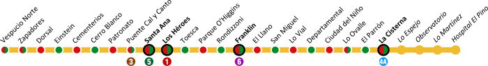
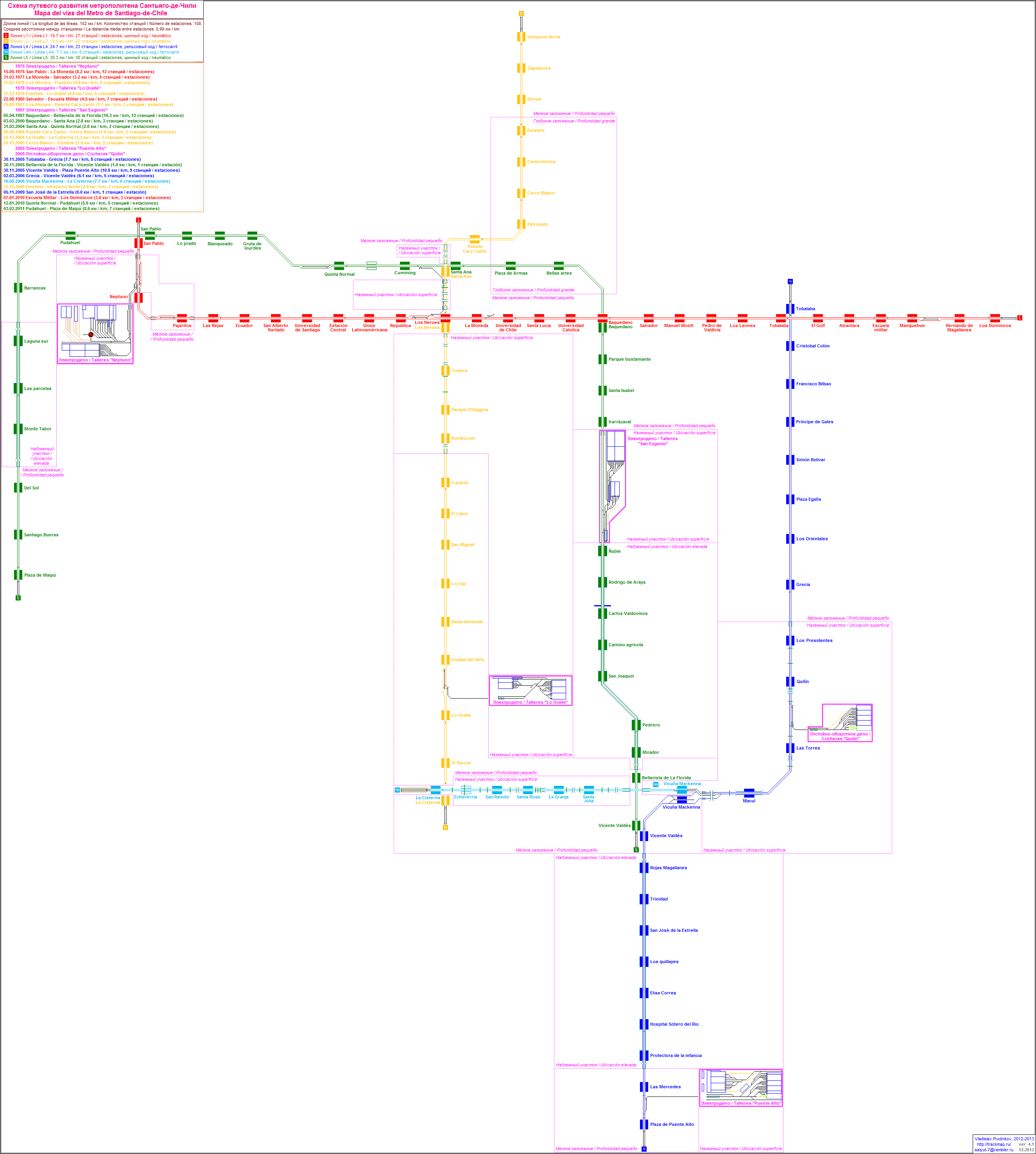
Santiago Metro Line 2 is one of the six lines that currently make up the Santiago Metro network in Santiago, Chile. It has 22 stations and 20.7 km of track. The line intersects with Line 1 at Los Héroes, with Line 4A at La Cisterna, with Line 5 at Santa Ana, and Line 6 at Franklin. It will also intersect with the future Line 3 and Line 7 at Puente Cal y Canto station. Its distinctive colour on the network map is yellow.
In 2015, Line 2 accounted for 18.8% of all trips made on the metro with a daily ridership of 325,400.
History
The first section on Line 2 opened to the public on March 31, 1978[1] running between Los Héroes station and Franklin station. Later the same year, in December, the next section opened running between Franklin station and Lo Ovalle station.
In 1987, two new stations opened at the line’s northern end, Santa Ana and Puente Cal y Canto. Much later, on September 8, 2004, two further stations opened to the north, Patronato and Cerro Blanco. These stations marked a new feat in Santiago and overall Chilean engineering by building under the Mapocho River and the Costanera Norte freeway. That year, the line was also extended to the south with the opening of La Cisterna station.
Another section opened in the north on November 25, 2005, running from Cerro Blanco station to Einstein station. Finally, on December 22, 2006, the most recent three stations opened: Vespucio Norte, Zapadores and Dorsal.
On October 26, 2009, the express service began to run on Line 2, stopping at certain stations only at peak times, allowing for faster journeys. Since 2009, the Municipality of San Bernardo and the Santiago Metro are rallying for a future extension of Line 2 to the south, running from La Cisterna to San Bernardo’s main square. The extension will include several new stations which will benefit people living in southern Santiago, especially in the towns of El Bosque and San Bernardo.
On November 2, 2017, line 6 was inaugurated, intersecting line 2 with line 6 at Franklin station.
Communes served by Line 2
This line serves the following communes from west to east:
Tren Expreso (Express Service)
The express service[2] works during peak hours and allows trains to stop at alternate stations, reducing the number of stops and the duration of journeys. The stations on the line are divided into “green route” stations, “red route” stations and “common” stations (Spanish: estación común), where all trains stop and allow passengers to switch between red and green routes. The express service works from Monday to Friday, between 6am - 9am and 6pm - 9pm.
Red Route Stations
Green Route Stations
Common Stations
There are 8 stations where both red and green route trains stop. They are the busiest stations and give commuters the chance to change between routes.
Stations
Line 2 stations from east to west are:
| Stations | Connections | Location | Opening | Commune | Notes |
|---|---|---|---|---|---|
| Vespucio Norte | Av. Americo Vespucio Norte/Principal Ignacio Carrera Pinto | Recoleta/Huechuraba | |||
| Zapadores | Av. Recoleta/Av. Zapadores | Recoleta | |||
| Dorsal | Av. Recoleta/Av. Dorsal | Recoleta | |||
| Einstein | Av. Recoleta/Av. Einstein | Recoleta | |||
| Cementerios | Av. Recoleta/Av. Arzobispo Valdivieso | Recoleta | |||
| Cerro Blanco | Av. Recoleta/Av. Santos Dumont | Recoleta | |||
| Patronato | Av. Recoleta/Av. Santa Filomena | Recoleta | |||
| Puente Cal y Canto | Bandera/Av. Balmaceda | Recoleta/Santiago | For the year 2019 it will be future combination with the Line | ||
| Santa Ana | Av. Manuel Rodriguez/Catedral | Santiago | |||
| Los Héroes | Av. Manuel Rodriguez/Av. Lib. Bdo. O'Higgins | Santiago | |||
| Toesca | Av. Presidente Jorge Alessandri/Toesca | Santiago | |||
| Parque O'Higgins | Av. Presidente Jorge Alessandri/Av. Manuel Antonio Matta | Santiago | |||
| Rondizzoni | Av. Presidente Jorge Alessandri/Av. Rondizzoni | Santiago | |||
| Franklin | Placer/Av. Nataniel Cox | Santiago/San Miguel | |||
| El Llano | Gran Avenida José Miguel Carrera/Av. José Joaquín Vallejos | San Miguel | |||
| San Miguel | Gran Avenida José Miguel Carrera/Curiñanca | San Miguel | |||
| Lo Vial | Gran Avenida José Miguel Carrera/Av. Blanco Viel | San Miguel | |||
| Departamental | Gran Avenida José Miguel Carrera/Carlos Edwards | San Miguel | |||
| Ciudad del Niño | Gran Avenida José Miguel Carrera/Varas Mena | San Miguel | |||
| Lo Ovalle | Gran Avenida José Miguel Carrera/Carvajal | La Cisterna | |||
| El Parrón | Gran Avenida José Miguel Carrera/Av. El Parrón | La Cisterna | |||
| La Cisterna | Gran Avenida José Miguel Carrera/Av. Américo Vespucio Sur | La Cisterna |
Line 2 data sheet
- Terminal Communes: Recoleta – La Cisterna
- Track:
- Americo Vespucio Avenue: 1 Station
- Recoleta Avenue: 6 stations
- Puente Cal y Canto, Puente Pedestrian Street: 1 station
- Manuel Rodríguez Avenue: 2 stations
- President Jorge Alessandri Avenue: 3 stations
- Gran Avenida José Miguel Carrera: 9 stations
- Construction methods:
- La Cisterna - Franklin: Underground.
- Rondizzoni - Santa Ana: Embankment.
- Puente Cal y Canto - Vespucio Norte: Underground.
- Opening dates:
- Los Héroes– Franklin: March 1978
- Franklin – Lo Ovalle: December 1978
- Los Héroes - Puente Cal y Canto: September 1987
- Puente Cal y Canto – Cerro Blanco: September 2004
- Lo Ovalle – La Cisterna: December 2004
- Cerro Blanco – Einstein: November 2005
- Einstein – Vespucio Norte : December 2006
See also
References
- ↑ Santiago’s Metro History (Spanish) www.metrosantiago.cl Retrieved April 20, 2013
- ↑ Guide to the Line 2's express service(Spanish) www.metrosantiago.cl Retrieved 20 April 2013
External links
| Wikimedia Commons has media related to Santiago Metro Line 2. |
- (in Spanish) Metro S.A.
- (in English) UrbanRail.net/Santiago
- (in Spanish) (in Russian) Santiago Metro Map
- (in Spanish) Tarjeta Bip! contactless cards
- (in Spanish) Plan and Authority of Transit of Santiago de Chile, Transantiago
- (in Spanish) Santiago Metro in Wikipedia in Spanish
| Lines | ||
|---|---|---|
| Related topics |
| |