Santiago, Washington
| Santiago, Washington | |
|---|---|
| Census-designated place | |
 Santiago  Santiago | |
| Coordinates: 47°17′46″N 124°14′16″W / 47.29611°N 124.23778°WCoordinates: 47°17′46″N 124°14′16″W / 47.29611°N 124.23778°W | |
| Country | United States |
| State | Washington |
| County | Grays Harbor |
| Area | |
| • Total | 1.57 sq mi (4.06 km2) |
| • Land | 1.57 sq mi (4.06 km2) |
| • Water | 0.0 sq mi (0.0 km2) |
| Elevation | 130 ft (40 m) |
| Population (2010) | |
| • Total | 42 |
| • Density | 27/sq mi (10.3/km2) |
| Time zone | UTC-8 (Pacific (PST)) |
| • Summer (DST) | UTC-7 (PDT) |
| Area code(s) | 360 |
| FIPS code | 53-61235 |
| GNIS feature ID | 2585033[1] |
Santiago is a census-designated place (CDP) in Grays Harbor County, Washington, United States. The population was 42 at the 2010 census.[2]
The community is in the Quinault Indian Nation in western Grays Harbor County, along State Route 109, next to the Pacific Ocean. SR 109 leads north 5 miles (8 km) to its northern terminus at Taholah and south 5 miles (8 km) to Moclips. Point Grenville, a 120-foot-high (37 m) cliff rising from the ocean, is 2.5 miles (4.0 km) north of Santiago and is the site of the Quinault Nations' Haynisisoos Park. The Copalis National Wildlife Refuge occupies the ocean and rocks seaward from the coastline along Santiago and environs.
According to the U.S. Census Bureau, the Santiago CDP has an area of 1.57 square miles (4.06 km2), all of it land.[2]
References
- ↑ "Santiago Census Designated Place". Geographic Names Information System. United States Geological Survey.
- 1 2 "Geographic Identifiers: 2010 Demographic Profile Data (G001): Santiago CDP, Washington". American Factfinder. U.S. Census Bureau. Retrieved March 31, 2017.
Municipalities and communities of Grays Harbor County, Washington, United States | ||
|---|---|---|
| Cities | 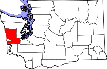 | |
| CDPs | ||
| Other unincorporated communities | ||
| Indian reservations | ||
| Footnotes | ‡This populated place also has portions in an adjacent county or counties | |