Queets, Washington
| Queets, Washington | |
|---|---|
| Census-designated place | |
 Queets  Queets | |
| Coordinates: 47°32′25″N 124°19′50″W / 47.54028°N 124.33056°WCoordinates: 47°32′25″N 124°19′50″W / 47.54028°N 124.33056°W | |
| Country | United States |
| State | Washington |
| Counties | Grays Harbor, Jefferson |
| Area | |
| • Total | 1.4 sq mi (3.7 km2) |
| • Land | 1.4 sq mi (3.6 km2) |
| • Water | 0.0 sq mi (0.0 km2) |
| Elevation | 30 ft (9 m) |
| Population (2010) | |
| • Total | 174 |
| • Density | 125/sq mi (48.3/km2) |
| Time zone | UTC-8 (Pacific (PST)) |
| • Summer (DST) | UTC-7 (PDT) |
| FIPS code | 53-56905[1] |
| GNIS feature ID | 1524759 |
Queets is an unincorporated community and census-designated place (CDP) in Grays Harbor and Jefferson counties, Washington, United States. The population was 174 at the 2010 census.[1] The primary residents of the community are Native Americans of the Quinault Indian Nation.
Geography
It is near the coast of the Pacific Ocean along the Queets River at the northern edge of the Quinault Indian Reservation. Queets now consists of several homes, a store, gas station, fisheries, daycare, Head Start, and a remote office for the Quinault Nation. Other local attractions include the Pacific beach hiking trails, Olympic National Park, and Olympic National Forest.
U.S. Route 101 passes through Queets, crossing the Queets River at the northern edge of the community. US 101 leads north 5 miles (8 km) to Kalaloch Beach and 39 miles (63 km) to Forks, site of the nearest airport. Southbound US 101 leads east 25 miles (40 km) to Amanda Park and southeast 68 miles (109 km) to Aberdeen.
According to the United States Census Bureau, the Queets CDP has a total area of 1.4 square miles (3.7 km2), of which 1.4 square miles (3.6 km2) are land and 0.04 square miles (0.1 km2), or 3.45%, are water.[1]
Demographics
At the 2010 census, more than 95% of the population identified their race as American Indian.[2]
History
The post office at Queets was established July 13, 1880, and discontinued July 31, 1934, with mail being sent to Clearwater, approximately 8 miles (13 km) away.[3]
References
- 1 2 3 "Geographic Identifiers: 2010 Demographic Profile Data (G001): Queets CDP, Washington". American Factfinder. U.S. Census Bureau. Retrieved March 31, 2017.
- ↑ "DP1: Profile of General Population and Housing Characteristics: Queets CDP, Washington". 2010 Demographic Profile Data. United States Census Bureau. 2010.
- ↑ Boardman, Tim, and Richard W. Helbock (1986) Washington Post Offices, p. 55, Lake Oswego, Oregon: La Posta Publications
Municipalities and communities of Grays Harbor County, Washington, United States | ||
|---|---|---|
| Cities | 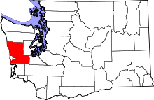 | |
| CDPs | ||
| Other unincorporated communities | ||
| Indian reservations | ||
| Footnotes | ‡This populated place also has portions in an adjacent county or counties | |
Municipalities and communities of Jefferson County, Washington, United States | ||
|---|---|---|
| City | 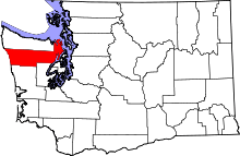 | |
| CDPs | ||
| Other unincorporated communities | ||
| Indian reservation | ||
| Ghost town | ||
| Footnotes | ‡This populated place also has portions in an adjacent county or counties | |