Sakarya River
| Sakarya River | |
|---|---|
 | |
| Country | Turkey |
| Physical characteristics | |
| Main source | Bayat Plateau |
| River mouth | Black Sea |
| Length | 824 km (512 mi) |
| Discharge |
|
| Basin features | |
| Basin size | 55,300 km2 (21,400 sq mi) |
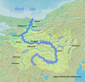
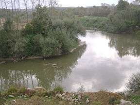
The Sakarya (Turkish: Sakarya Irmağı, Greek: Σαγγάριος, translit. Sangarios) is the third longest river in Turkey. It runs through what in ancient times was known as Phrygia.
The source of the river is the Bayat Yaylası (Bayat Plateau) which is located to the northeast of Afyon. Joined by the Porsuk Çayı (Porsuk Creek) close by the town of Polatlı, the river runs through the Adapazarı Ovası (Adapazarı Plains) before reaching the Black Sea. The Sakarya was once crossed by the Sangarius Bridge, constructed by the East Roman Emperor Justinian I (r. 527–565).
In the Middle Ages, the valley of the Sakarya was the home of the Söğüt tribe, which went on to establish the Ottoman Empire.
From downstream to upstream, it is dammed at Gölpazarı, Yenice, Gökçekaya and Sarıyar.
See also
| Wikimedia Commons has media related to Sakarya river. |
Coordinates: 41°07′35″N 30°38′56″E / 41.1264°N 30.6489°E