San Felipe del Rey, Venezuela
| San Felipe | ||
|---|---|---|
    | ||
| ||
| Nickname(s): La Ciudad más dulce de Venezuela (the sweetest city in Venezuela) | ||
.svg.png) San Felipe | ||
| Coordinates: 10°20′26″N 68°44′13″W / 10.34056°N 68.73694°WCoordinates: 10°20′26″N 68°44′13″W / 10.34056°N 68.73694°W | ||
| Country |
| |
| State | Yaracuy | |
| Founded | 1729 | |
| Government | ||
| • Mayor | Francisco Capdevielle (PSUV) | |
| Elevation | 250 m (820 ft) | |
| Population (2001) | ||
| • Total | 220,786 | |
| • Density | 467.766/km2 (1,211.51/sq mi) | |
| • Demonym | San Felipeña/o | |
| Time zone | UTC-4:30 (VST) | |
| • Summer (DST) | UTC-4:30 (not observed) | |
| Postal code | 3201 | |
| Area code(s) | 0254 | |
| Website | Alcaldía de San Felipe (in Spanish) | |
| Population is metropolitan area. City itself: 103.121. | ||
San Felipe del Rey (Spanish pronunciation: [saɱ feˈlipe]) is a city in Venezuela. It is the capital of the state of Yaracuy.
San Felipe is situated in a rich agricultural region of Western Venezuela and produces many agricultural products for the rest of the country such as sugar cane, milk, livestock, grains and flour. It is the seat of the Roman Catholic Diocese of San Felipe.
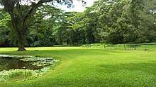
Landscape in San Felipe.
Notable people
Transport
The town is/was served by a station on the national railway network.
Sub Teniente Nestor Arias Airport is 5 kilometres (3.1 mi) south of the town.
Gallery Images
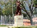
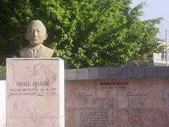 Rafael Andrade Square
.jpg) Bolivar Square
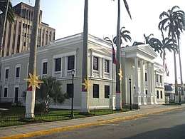
Bolivar Square- San Felipe Cathedral
 Jacobo Ramirez Theatre
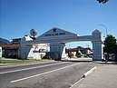
.jpg) Br. Figueira Trinidad square, the fields Oasis in San Felipe
Br. Figueira Trinidad square, the fields Oasis in San Felipe
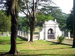
San Felipe El Fuerte Park.
See also
References
Capital, state | ||||||
Bold indicates national capital. | ||||||
This article is issued from
Wikipedia.
The text is licensed under Creative Commons - Attribution - Sharealike.
Additional terms may apply for the media files.