Saint-Quentin Parish, New Brunswick
| Saint-Quentin St. Quentin | |
|---|---|
| Parish | |
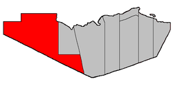 Location within Restigouche County. | |
| Coordinates: 47°45′36″N 67°50′33″W / 47.76°N 67.8425°W | |
| Country |
|
| Province |
|
| County | Restigouche |
| Established | 1920 |
| Area[1] | |
| • Land | 2,478.88 km2 (957.10 sq mi) |
| Population (2011)[1] | |
| • Total | 1,489 |
| • Density | 0.6/km2 (2/sq mi) |
| • Pop 2006-2011 |
|
| • Dwellings | 642 |
| Time zone | UTC-4 (AST) |
| • Summer (DST) | UTC-3 (ADT) |
Saint-Quentin is a Canadian parish in Restigouche County, New Brunswick.[2]
Delineation
Saint-Quentin Parish is defined in the Territorial Division Act[3] as being bounded:
- On the north by the Parish of Grimmer and the Province of Quebec; on the west by the Province of Quebec; on the southwest by the Counties of Victoria and Madawaska, and on the east by the Parishes of Grimmer and Eldon.
Communities
Parish population total does not include incorporated municipalities (in bold).
|
|
Demographics
Population
| Canada census – Saint-Quentin Parish, New Brunswick community profile | |||
|---|---|---|---|
| 2011 | 2006 | ||
| Population: | 1,489 (-5.6% from 2006) | 1,578 (+1.3% from 2001) | |
| Land area: | 2,478.88 km2 (957.10 sq mi) | 2,478.88 km2 (957.10 sq mi) | |
| Population density: | 0.6/km2 (1.6/sq mi) | 0.6/km2 (1.6/sq mi) | |
| Median age: | 44.7 (M: 44.4, F: 45.0) | 39.9 (M: 40.7, F: 38.6) | |
| Total private dwellings: | 642 | 732 | |
| Median household income: | $.N/A | $41,384 | |
| Notes: Data for this area has been suppressed for data quality or confidentiality reasons. – References: 2011[1] 2006[4] earlier[5] | |||
| Historical Census Data - Saint-Quentin Parish, New Brunswick[6] | ||||||||||||||||||||||||||
|---|---|---|---|---|---|---|---|---|---|---|---|---|---|---|---|---|---|---|---|---|---|---|---|---|---|---|
|
|
| ||||||||||||||||||||||||
Language
| Canada Census Mother Tongue - Saint-Quentin Parish, New Brunswick[6] | ||||||||||||||||||
|---|---|---|---|---|---|---|---|---|---|---|---|---|---|---|---|---|---|---|
| Census | Total | French |
English |
French & English |
Other | |||||||||||||
| Year | Responses | Count | Trend | Pop % | Count | Trend | Pop % | Count | Trend | Pop % | Count | Trend | Pop % | |||||
2011 |
1,480 |
1,450 | 97.97% | 20 | 1.35% | 5 | 0.34% | 5 | 0.34% | |||||||||
2006 |
1,585 |
1,435 | 90.54% | 70 | 4.42% | 0 | 0.00% | 80 | 5.05% | |||||||||
2001 |
1,540 |
1,530 | 99.35% | 0 | 0.00% | 10 | 0.65% | 0 | 0.00% | |||||||||
1996 |
0 |
1,515 | n/a | 0.00% | 35 | n/a | 0.00% | 0 | n/a | 0.00% | 0 | n/a | 0.00% | |||||
Access Routes
Highways and numbered routes that run through the parish, including external routes that start or finish at the parish limits:[7]
See also
References
- 1 2 3 "2011 Community Profiles". Canada 2011 Census. Statistics Canada. July 5, 2013. Retrieved 2014-03-21.
- ↑ New Brunswick Provincial Archives - Saint-Quentin Parish
- ↑ "Territorial Division Act (R.S.N.B. 1973, c. T-3)". Government of New Brunswick website. Retrieved 25 August 2016.
- ↑ "2006 Community Profiles". Canada 2006 Census. Statistics Canada. March 30, 2011. Retrieved 2014-03-21.
- ↑ "2001 Community Profiles". Canada 2001 Census. Statistics Canada. February 17, 2012.
- 1 2 Statistics Canada: 1996, 2001, 2006, 2011 census
- ↑ Atlantic Canada Back Road Atlas ISBN 978-1-55368-618-7 Pages 12-13
Places adjacent to Saint-Quentin Parish, New Brunswick | |
|---|---|
| Subdivisions | |
|---|---|
| Cities | |
| Counties | |
| |
Coordinates: 47°45′36″N 67°50′33″W / 47.76000°N 67.84250°W
This article is issued from
Wikipedia.
The text is licensed under Creative Commons - Attribution - Sharealike.
Additional terms may apply for the media files.