Saint-Barnabé-Sud, Quebec
| Saint-Barnabé-Sud | |
|---|---|
| Municipality | |
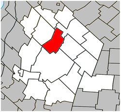 Location within Les Maskoutains RCM. | |
 Saint-Barnabé-Sud Location in southern Quebec. | |
| Coordinates: 45°44′N 72°55′W / 45.733°N 72.917°WCoordinates: 45°44′N 72°55′W / 45.733°N 72.917°W[1] | |
| Country |
|
| Province |
|
| Region | Montérégie |
| RCM | Les Maskoutains |
| Constituted | July 1, 1855 |
| Government[2][3] | |
| • Mayor | Richard Leblanc |
| • Federal riding | Saint-Hyacinthe—Bagot |
| • Prov. riding | Saint-Hyacinthe |
| Area[2][4] | |
| • Total | 58.10 km2 (22.43 sq mi) |
| • Land | 57.40 km2 (22.16 sq mi) |
| Population (2011)[4] | |
| • Total | 859 |
| • Density | 15.0/km2 (39/sq mi) |
| • Pop 2006-2011 |
|
| • Dwellings | 346 |
| Time zone | UTC−5 (EST) |
| • Summer (DST) | UTC−4 (EDT) |
| Postal code(s) | J0H 1G0 |
| Area code(s) | 450 and 579 |
| Highways |
|
Saint-Barnabé-Sud is a municipality in southwestern Quebec in the Regional County Municipality of Les Maskoutains. The population as of the Canada 2011 Census was 859. It is the birthplace of historian Jean-Baptiste-Arthur Allaire.
Demographics
Population
| Canada census – Saint-Barnabé-Sud, Quebec community profile | |||
|---|---|---|---|
| 2011 | 2006 | ||
| Population: | 859 (-0.6% from 2006) | 864 (-2.3% from 2001) | |
| Land area: | 57.40 km2 (22.16 sq mi) | 57.40 km2 (22.16 sq mi) | |
| Population density: | 15.0/km2 (39/sq mi) | 15.1/km2 (39/sq mi) | |
| Median age: | 40.2 (M: 40.2, F: 40.1) | 40.2 (M: 40.1, F: 40.3) | |
| Total private dwellings: | 346 | 332 | |
| Median household income: | $55,141 | $50,413 | |
| References: 2011[4] 2006[5] earlier[6] | |||
| Historical Census Data - Saint-Barnabé-Sud, Quebec[7] | ||||||||||||||||||||||||||
|---|---|---|---|---|---|---|---|---|---|---|---|---|---|---|---|---|---|---|---|---|---|---|---|---|---|---|
|
|
| ||||||||||||||||||||||||
Language
| Canada Census Mother Tongue - Saint-Barnabé-Sud, Quebec[7] | ||||||||||||||||||
|---|---|---|---|---|---|---|---|---|---|---|---|---|---|---|---|---|---|---|
| Census | Total | French |
English |
French & English |
Other | |||||||||||||
| Year | Responses | Count | Trend | Pop % | Count | Trend | Pop % | Count | Trend | Pop % | Count | Trend | Pop % | |||||
2011 |
850 |
840 | 98.82% | 10 | 1.18% | 0 | 0.00% | 0 | 0.00% | |||||||||
2006 |
865 |
865 | 100.00% | 0 | 0.00% | 0 | 0.00% | 0 | 0.00% | |||||||||
2001 |
895 |
865 | 96.65% | 10 | 1.12% | 10 | 1.12% | 10 | 1.12% | |||||||||
1996 |
885 |
865 | n/a | 97.74% | 20 | n/a | 2.26% | 0 | n/a | 0.00% | 0 | n/a | 0.00% | |||||
Communities
- Saint-Barnabé-Sud
Death of infant, 2010
On June 7, 2010, police reported that a 20-day-old infant in Saint-Barnabé-Sud had been killed by a dog, a Siberian Husky, that afternoon.[8][9]
See also
References
- ↑ Reference number 278441 of the Commission de toponymie du Québec (in French)
- 1 2 Ministère des Affaires municipales, des Régions et de l'Occupation du territoire: Saint-Barnabé-Sud
- ↑ Parliament of Canada Federal Riding History: SAINT-HYACINTHE--BAGOT (Quebec)
- 1 2 3 "2011 Community Profiles". Canada 2011 Census. Statistics Canada. July 5, 2013. Retrieved 2014-03-16.
- ↑ "2006 Community Profiles". Canada 2006 Census. Statistics Canada. March 30, 2011. Retrieved 2014-03-16.
- ↑ "2001 Community Profiles". Canada 2001 Census. Statistics Canada. February 17, 2012.
- 1 2 Statistics Canada: 1996, 2001, 2006, 2011 census
- ↑ "Dog kills Quebec newborn". The Globe and Mail. Canadian Press. June 7, 2010. Retrieved June 7, 2010.
- ↑ "Un bébé est tué par un chien à Saint-Barnabé". Canoe. Agence QMI. June 7, 2010. Archived from the original on January 1, 2013. Retrieved June 7, 2010.
- "Saint-Barnabé-Sud". Commission de toponymie. Retrieved June 7, 2010.
- Répertoire des municipalités du Québec
- Affaires municipales et régions - cartes régionales
Adjacent Municipal Subdivisions | ||||||||||
|---|---|---|---|---|---|---|---|---|---|---|
| ||||||||||
| Cities | |
|---|---|
| Municipalities | |
| Parishes | |
| Villages | |
| |
This article is issued from
Wikipedia.
The text is licensed under Creative Commons - Attribution - Sharealike.
Additional terms may apply for the media files.