Saint-Augustin-de-Woburn
| Saint-Augustin-de-Woburn | |
|---|---|
| Parish municipality | |
 | |
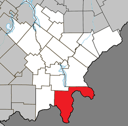 Location within Le Granit RCM | |
 Saint-Augustin-de-Woburn Location in southern Quebec | |
| Coordinates: 45°23′N 70°51′W / 45.38°N 70.85°WCoordinates: 45°23′N 70°51′W / 45.38°N 70.85°W[1] | |
| Country |
|
| Province |
|
| Region | Estrie |
| RCM | Le Granit |
| Constituted | January 13, 1900 |
| Government[2] | |
| • Mayor | Steve Charrier |
| • Federal riding | Mégantic—L'Érable |
| • Prov. riding | Mégantic |
| Area[2][3] | |
| • Total | 284.10 km2 (109.69 sq mi) |
| • Land | 280.63 km2 (108.35 sq mi) |
| Population (2011)[3] | |
| • Total | 695 |
| • Density | 2.5/km2 (6/sq mi) |
| • Pop 2006-2011 |
|
| • Dwellings | 328 |
| Time zone | UTC−5 (EST) |
| • Summer (DST) | UTC−4 (EDT) |
| Postal code(s) | G0Y 1R0 |
| Area code(s) | 819 |
| Highways |
|
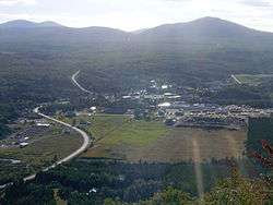
Saint-Augustin-de-Woburn, known locally as Woburn, is a parish municipality in Le Granit Regional County Municipality in the Estrie region of Quebec, Canada, on the Canada–United States border. The population is 695 as of the Canada 2011 Census.
Overview
Mount Gosford lies entirely within the parish, making Woburn one of the highest towns in Quebec, at an altitude of 1,193 metres (3,914 ft).
The border crossing of Woburn-Coburn Gore is located roughly five kilometres from the town centre, linking Quebec Route 161 with Maine State Route 27. The border crossing offers a 24-hour year-round service.
See also
References
External links

Places adjacent to Saint-Augustin-de-Woburn | ||||||||||
|---|---|---|---|---|---|---|---|---|---|---|
| ||||||||||
| Cities | |
|---|---|
| Municipalities | |
| Parishes | |
| Townships | |
| |
This article is issued from
Wikipedia.
The text is licensed under Creative Commons - Attribution - Sharealike.
Additional terms may apply for the media files.