Sacaton Flats Village, Arizona
| Sacaton Flats Village, Arizona O'odham: Ha:shañ Ke:k | |
|---|---|
| CDP | |
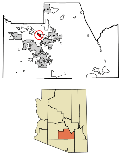 Location of Sacaton Flats Village in Pinal County, Arizona. | |
 Sacaton Flats Village, Arizona Location in the United States | |
| Coordinates: 33°16′34″N 112°10′1″W / 33.27611°N 112.16694°WCoordinates: 33°16′34″N 112°10′1″W / 33.27611°N 112.16694°W | |
| Country | United States |
| State | Arizona |
| County | Maricopa |
| Area[1] | |
| • Total | 6.24 sq mi (16.15 km2) |
| • Land | 6.24 sq mi (16.15 km2) |
| • Water | 0.00 sq mi (0.00 km2) |
| Population (2010) | |
| • Total | 26,361 |
| • Estimate (2016)[2] | N/A |
| Time zone | UTC-7 (MST (no DST)) |
| FIPS code | 04-61800 |
Sacaton Flats Village (O'odham: Ha:shañ Ke:k) is a census-designated place (CDP) in Pinal County, Arizona, United States, located in the Gila River Indian Community. The population was 621 at the 2010 census.
Demographics
| Historical population | |||
|---|---|---|---|
| Census | Pop. | %± | |
| U.S. Decennial Census[3] | |||
As of the census[4] of 2010, there were 541 people residing in the CDP. The population density was 86.8 people per square mile. The racial makeup of the CDP was 1.29% White, 0.18% Black or African American, 95.56% Native American, and 2.96% from two or more races. 11.65% of the population were Hispanic or Latino of any race.

Notes
- ↑ "2016 U.S. Gazetteer Files". United States Census Bureau. Retrieved Jul 18, 2017.
- ↑ "Population and Housing Unit Estimates". Retrieved June 9, 2017.
- ↑ "Census of Population and Housing". Census.gov. Retrieved June 4, 2016.
- ↑ http://factfinder2.census.gov/faces/tableservices/jsf/pages/productview.xhtml?pid=DEC_10_PL_GCTPL2.ST13&prodType=table
This article is issued from
Wikipedia.
The text is licensed under Creative Commons - Attribution - Sharealike.
Additional terms may apply for the media files.