Sacaton Flats, Arizona
| Sacaton Flats, Arizona | |
|---|---|
| Populated place | |
 Sacaton Flats Location within the state of Arizona  Sacaton Flats Sacaton Flats (the US) | |
| Coordinates: 33°04′12″N 111°40′06″W / 33.07000°N 111.66833°WCoordinates: 33°04′12″N 111°40′06″W / 33.07000°N 111.66833°W | |
| Country | United States |
| State | Arizona |
| County | Pinal |
| Elevation[1] | 1,309 ft (399 m) |
| Time zone | UTC-7 (Mountain (MST)) |
| • Summer (DST) | UTC-7 (MST) |
| Area code(s) | 520 |
| FIPS code | 04-61790 |
| GNIS feature ID | 24593 |
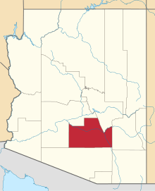
Sacaton Flats is a populated place situated in Pinal County, Arizona, United States.[2] It has an estimated elevation of 1,309 feet (399 m) above sea level.[1]
Education
Blackwater Community School, a grade K-2 Bureau of Indian Education Grant School, and Akimel O'Otham Pee Posh Charter School Inc., a grade 3-5 state charter school, are co-located in Blackwater and operate de facto as a single school. Blackwater Community School opened in 1939 to serve Blackwater and Sacaton Flats. Initially the school had fewer than 100 students. In 2000 the charter school opened; the U.S. Congress had a moratorium on the expansion of BIE schools, and the Blackwater community wanted an expansion of the Blackwater Community School. The charter school opened as a way of expanding the school.[3]
References
- 1 2 "Feature Detail Report for: Sacaton Flats". Geographic Names Information System. United States Geological Survey.
- ↑ "Sacaton Flats (in Pinal County, AZ) Populated Place Profile". AZ Hometown Locator. Retrieved March 2, 2017.
- ↑ "About Us." Blackwater Community School. Retrieved on July 9, 2017.
