Sacate Village, Arizona
| Sacate Village, Arizona | |
|---|---|
| CDP | |
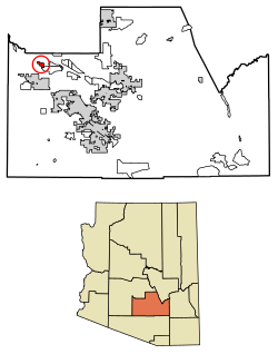 Location of Sacate Village in Pinal County, Arizona. | |
 Sacate Village, Arizona Location in the United States  Sacate Village, Arizona Sacate Village, Arizona (the US) | |
| Coordinates: 33°8′30″N 111°58′52″W / 33.14167°N 111.98111°WCoordinates: 33°8′30″N 111°58′52″W / 33.14167°N 111.98111°W | |
| Country | United States |
| State | Arizona |
| County | Pinal |
| Area[1] | |
| • Total | 3.48 sq mi (9.02 km2) |
| • Land | 3.48 sq mi (9.02 km2) |
| • Water | 0.00 sq mi (0.00 km2) |
| Population (2010) | |
| • Total | 26,361 |
| • Estimate (2016)[2] | N/A |
| Time zone | UTC-7 (MST (no DST)) |
| FIPS code | 04-61715 |
Sacate Village is a census-designated place in Pinal County, in the U.S. state of Arizona.[3] The population was 169 at the 2010 census.[4]
Demographics
| Historical population | |||
|---|---|---|---|
| Census | Pop. | %± | |
| U.S. Decennial Census[5] | |||
References
- ↑ "2016 U.S. Gazetteer Files". United States Census Bureau. Retrieved Jul 18, 2017.
- ↑ "Population and Housing Unit Estimates". Retrieved June 9, 2017.
- ↑ U.S. Geological Survey Geographic Names Information System: Sacate Village, Arizona
- ↑ "2010 Census Gazetteer Files - Places: New Mexico". U.S. Census Bureau. Retrieved February 26, 2017.
- ↑ "Census of Population and Housing". Census.gov. Retrieved June 4, 2016.

This article is issued from
Wikipedia.
The text is licensed under Creative Commons - Attribution - Sharealike.
Additional terms may apply for the media files.