Südtondern
| Südtondern | ||
|---|---|---|
| ||
 Südtondern Location of Südtondern within Nordfriesland district 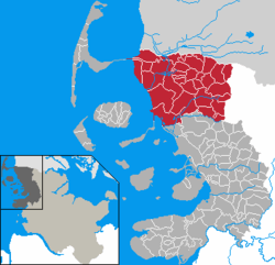 | ||
| Coordinates: 54°47′0″N 08°50′0″E / 54.78333°N 8.83333°ECoordinates: 54°47′0″N 08°50′0″E / 54.78333°N 8.83333°E | ||
| Country | Germany | |
| State | Schleswig-Holstein | |
| District | Nordfriesland | |
| Founded | 2008 | |
| Government | ||
| • Head official | Peter Ewaldsen | |
| Area | ||
| • Total | 594.4 km2 (229.5 sq mi) | |
| Population (2016-12-31)[1] | ||
| • Total | 39,566 | |
| • Density | 67/km2 (170/sq mi) | |
| Time zone | CET/CEST (UTC+1/+2) | |
| Vehicle registration | NF | |
| Website | Amt Südtondern | |

Südtondern is an Amt ("collective municipality") in the district of Nordfriesland, in Schleswig-Holstein, Germany.
History
Its seat is in Niebüll. It was formed on 1 January 2008 from the former Ämter Bökingharde, Karrharde, Süderlügum and Wiedingharde, and the municipalities Niebüll and Leck.
In addition to the main seat in Niebüll, there are offices in Leck, Risum-Lindholm and Süderlügum.
Subdivision
The Amt Südtondern consists of the following municipalities:
- Achtrup
- Aventoft
- Bosbüll
- Braderup
- Bramstedtlund
- Dagebüll
- Ellhöft
- Emmelsbüll-Horsbüll
- Enge-Sande
- Friedrich-Wilhelm-Lübke-Koog
- Galmsbüll
- Holm
- Humptrup
- Karlum
- Klanxbüll
- Klixbüll
- Ladelund
- Leck
- Lexgaard
- Neukirchen
- Niebüll
- Risum-Lindholm
- Rodenäs
- Sprakebüll
- Stadum
- Stedesand
- Süderlügum
- Tinningstedt
- Uphusum
- Westre
References
This article is issued from
Wikipedia.
The text is licensed under Creative Commons - Attribution - Sharealike.
Additional terms may apply for the media files.