São Salvador do Mundo, Cape Verde
| São Salvador do Mundo | |
|---|---|
| Municipality | |
_(3).jpg) | |
 | |
| Coordinates: 15°04′N 23°38′W / 15.07°N 23.63°WCoordinates: 15°04′N 23°38′W / 15.07°N 23.63°W | |
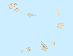
| Country | Cape Verde |
| Island | Santiago |
| Area | |
| • Total | 26.5 km2 (10.2 sq mi) |
| Population (2010)[1] | |
| • Total | 8,677 |
| • Density | 330/km2 (850/sq mi) |
São Salvador do Mundo is a concelho (municipality) of Cape Verde. It is situated in the central part of the island of Santiago. Its seat is the city Picos. Its population was 8,643 at the 2010 census.[1] The municipality borders Santa Cruz to the northeast, São Lourenço dos Órgãos to the southeast, Ribeira Grande de Santiago to the southwest and Santa Catarina to the northwest.
Subdivisions
The municipality consists of one freguesia (civil parish), São Salvador do Mundo. The freguesia is subdivided into the following settlements (population data from the 2010 census):
- Aboboreiro (pop: 532)
- Achada Leitão (pop: 1,160)
- Babosa (pop: 183)
- Burbur (pop: 131)
- Covão Grande (pop: 478)
- Degredo (pop: 148)
- Djéu (pop: 90)
- Faveta (pop: 247)
- Jalalo Ramos (pop: 239)
- Junco (pop: 266)
- Leitão Grande (pop: 927)
- Leitãozinho (pop: 460)
- Manhanga (pop: 177)
- Mato Fortes (pop: 179)
- Mato Limão (pop: 134)
- Pico Freire (pop: 546)
- Picos (also: Achada Igreja, pop: 986, city)[2]
- Picos Acima (pop: 1,489)
- Purgueira (pop: 217)
- Rebelo Acima (pop: 54)
History
It was created in 2005, when a parish of the older Municipality of Santa Catarina was separated to become the Municipality of São Salvador do Mundo.[3]
Demography
| Population of São Salvador do Mundo (2000—2010) | |||||||
|---|---|---|---|---|---|---|---|
| 2000[4] | 2010[1] | ||||||
| 9214 | 8643 | ||||||
Politics
At the federal level, it belongs to the constituency of Santiago North. Since 2016, the Movement for Democracy (MpD) is the ruling party of the municipality. The results of the latest elections, in 2016:[5]
| Party | Municipal Council | Municipal Assembly | ||
|---|---|---|---|---|
| Votes% | Seats | Votes% | Seats | |
| MpD | 51.94 | 5 | 52.41 | 7 |
| PAICV | 45.14 | 0 | 44.85 | 6 |
External links
References
- 1 2 3 "2010 Census results". Instituto Nacional de Estatística Cabo Verde (in Portuguese). 24 November 2016.
- ↑ Cabo Verde, Statistical Yearbook 2015, Instituto Nacional de Estatística, p. 32-33
- ↑ Lei nº 65/VI/2005, p. 43
- ↑ Source: projections from the Instituto Nacional de Estatísticas.
- ↑ Official results local elections 2016, Boletim Oficial I Série, Número 53, 23 September 2016