Ruino
| Ruino | |
|---|---|
| Comune | |
| Comune di Ruino | |
 | |
 Ruino Location of Ruino in Italy | |
| Coordinates: 44°55′N 9°17′E / 44.917°N 9.283°ECoordinates: 44°55′N 9°17′E / 44.917°N 9.283°E | |
| Country | Italy |
| Region | Lombardy |
| Province | Pavia (PV) |
| Frazioni | Ca del Matto, Ca del Zerbo, Canavera, Carmine Passo, Carmine Bivio, Costa Trentini, Montelungo, Montù Berchielli, Pometo (municipal seat), Torre degli Alberi |
| Government | |
| • Mayor | Sergio Lodigiani |
| Area | |
| • Total | 21.46 km2 (8.29 sq mi) |
| Elevation | 541 m (1,775 ft) |
| Population (31 December 2010)[1] | |
| • Total | 755 |
| • Density | 35/km2 (91/sq mi) |
| Demonym(s) | Ruinesi |
| Time zone | UTC+1 (CET) |
| • Summer (DST) | UTC+2 (CEST) |
| Postal code | 27040 |
| Dialing code | 0385 |
| Website | Official website |
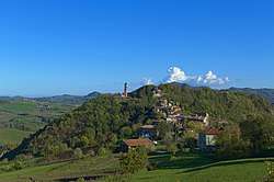
Ruino is a comune (municipality) in the Province of Pavia in the Italian region Lombardy, located about 60 km south of Milan and about 30 km southeast of Pavia.
The center of the municipality is the village of Pometo. Pometo, whose population numbers 200, is known for bread production.[2]
Ruino borders the following municipalities: Alta Val Tidone, Borgoratto Mormorolo, Canevino, Fortunago, Montalto Pavese, Rocca de' Giorgi, Val di Nizza, Valverde, Zavattarello.
References
- ↑ All demographics and other statistics: Italian statistical institute Istat.
- ↑ http://ricerca.gelocal.it/laprovinciapavese/archivio/laprovinciapavese/2010/08/29/PZ2PO_PZ203.html

This article is issued from
Wikipedia.
The text is licensed under Creative Commons - Attribution - Sharealike.
Additional terms may apply for the media files.