Monticelli Pavese
| Monticelli Pavese | |
|---|---|
| Comune | |
| Comune di Monticelli Pavese | |
 Monticelli Pavese Location of Monticelli Pavese in Italy | |
| Coordinates: 45°7′N 9°31′E / 45.117°N 9.517°ECoordinates: 45°7′N 9°31′E / 45.117°N 9.517°E | |
| Country | Italy |
| Region | Lombardy |
| Province | Province of Pavia (PV) |
| Area | |
| • Total | 20.2 km2 (7.8 sq mi) |
| Population (Dec. 2004) | |
| • Total | 737 |
| • Density | 36/km2 (94/sq mi) |
| Time zone | UTC+1 (CET) |
| • Summer (DST) | UTC+2 (CEST) |
| Postal code | 27010 |
| Dialing code | 0382 |
Monticelli Pavese is a comune (municipality) in the Province of Pavia in the Italian region Lombardy, located about 50 km southeast of Milan and about 30 km east of Pavia. As of 31 December 2004, it had a population of 737 and an area of 20.2 km².[1]
Monticelli Pavese borders the following municipalities: Badia Pavese, Calendasco, Chignolo Po, Orio Litta, Pieve Porto Morone, Rottofreno, Sarmato.
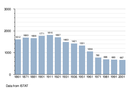
Demographic evolution
References

This article is issued from
Wikipedia.
The text is licensed under Creative Commons - Attribution - Sharealike.
Additional terms may apply for the media files.