Linarolo
| Linarolo | |
|---|---|
| Comune | |
| Comune di Linarolo | |
 Linarolo Location of Linarolo in Italy | |
| Coordinates: 45°10′N 9°16′E / 45.167°N 9.267°ECoordinates: 45°10′N 9°16′E / 45.167°N 9.267°E | |
| Country | Italy |
| Region | Lombardy |
| Province | Province of Pavia (PV) |
| Frazioni | Ospedaletto, San Leonardo, Vaccarizza |
| Area | |
| • Total | 12.3 km2 (4.7 sq mi) |
| Elevation | 76 m (249 ft) |
| Population (Dec. 2004) | |
| • Total | 2,200 |
| • Density | 180/km2 (460/sq mi) |
| Demonym(s) | Linarolesi |
| Time zone | UTC+1 (CET) |
| • Summer (DST) | UTC+2 (CEST) |
| Postal code | 27010 |
| Dialing code | 0382 |
Linarolo is a comune (municipality) in the Province of Pavia in the Italian region Lombardy, located about 35 km south of Milan and about 9 km east of Pavia. As of 31 December 2004, it had a population of 2,200 and an area of 12.3 km².[1]
The municipality of Linarolo contains the frazioni (subdivisions, mainly villages and hamlets) Ospedaletto, San Leonardo, and Vaccarizza.
Linarolo borders the following municipalities: Albaredo Arnaboldi, Albuzzano, Belgioioso, Mezzanino, Travacò Siccomario, Valle Salimbene.
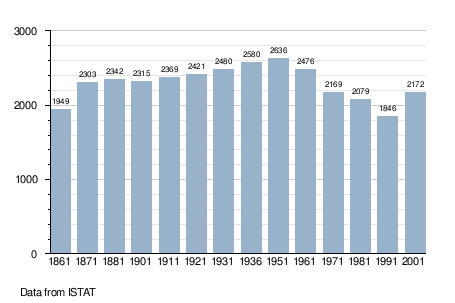
Demographic evolution
References

This article is issued from
Wikipedia.
The text is licensed under Creative Commons - Attribution - Sharealike.
Additional terms may apply for the media files.