Ruddell, Saskatchewan
| Ruddle | |
|---|---|
| Village | |
| Village of Ruddell | |
 Location of Ruddell in Saskatchewan  Ruddell, Saskatchewan (Canada) | |
| Coordinates: 52°36′0″N 107°51′0″W / 52.60000°N 107.85000°WCoordinates: 52°36′0″N 107°51′0″W / 52.60000°N 107.85000°W | |
| Country | Canada |
| Province | Saskatchewan |
| Region | West-central |
| Census division | 16 |
| Rural Municipality | Mayfield |
| Post office Founded | 1906-01-15 |
| Government | |
| • Type | Municipal |
| • Governing body | Ruddle Village Council |
| • Mayor | Linda Mushka |
| • Administrator | Darrin Beaudoin |
| Area | |
| • Total | 0.47 km2 (0.18 sq mi) |
| Population (2006) | |
| • Total | 20 |
| • Density | 42.5/km2 (110/sq mi) |
| Time zone | CST |
| Postal code | S0M 2S0 |
| Area code(s) | 306 |
| Highways |
|
| Railways | Canadian National Railway |
| [1][2][3] | |
Ruddell (2006 Population 20) is a village within the rural municipality of Mayfield No. 406, Saskatchewan, Canada. The village is located on Highway 16, or more commonly known as the Yellowhead highway, 36.7 km east of the city of North Battleford and 102 km west of the city of Saskatoon.[4] Ruddell post office first opened in 1906 at the legal land description of Sec.7, Twp.42, R.13, W3 - .[5]
Demographics
| Canada census – Ruddell, Saskatchewan community profile | |||
|---|---|---|---|
| 2016 | 2011 | 2006 | |
| Population: | 20 (0.0% from 2011) | 20 (0.0% from 2006) | 20 (-20% from 2001) |
| Land area: | 0.47 km2 (0.18 sq mi) | 0.47 km2 (0.18 sq mi) | 0.47 km2 (0.18 sq mi) |
| Population density: | 42.5/km2 (110/sq mi) | 42.5/km2 (110/sq mi) | 42.5/km2 (110/sq mi) |
| Median age: | N/A (M: N/A, F: N/A) | N/A (M: N/A, F: N/A) | N/A (M: N/A, F: N/A) |
| Total private dwellings: | 15 | 12 | 15 |
| Median household income: | $N/A | $N/A | $N/A |
| References: 2016[6] 2011[7] 2006[8] earlier[9] | |||
Area statistics
- Lat (DMS) 52° 36' 00" N
- Long (DMS) 107° 51' 00" W
- Dominion Land Survey Sec.7, Twp.42, R.13, W3
- Time zone (cst) UTC-6
See also
References
- ↑ National Archives, Archivia Net, Post Offices and Postmasters, archived from the original on 2006-10-06, retrieved 2007-05-26
- ↑ Government of Saskatchewan, MRD Home. "Municipal Directory System". Archived from the original on 2016-01-15. Retrieved 2013-11-26.
- ↑ Canadian Textiles Institute. (2005), CTI Determine your provincial constituency, archived from the original on 2007-09-11, retrieved 2007-04-24
- ↑ Adamson, J, Rand McNally 1924 Saskatchewan Map, retrieved 2008-03-26
- ↑ National Archives, Archivia Net, Post Offices and Postmasters, retrieved 2008-03-26
- ↑ "2016 Community Profiles". Canada 2016 Census. Statistics Canada. February 21, 2017.
- ↑ "2011 Community Profiles". Canada 2011 Census. Statistics Canada. July 5, 2013. Retrieved 2009-02-24.
- ↑ "2006 Community Profiles". Canada 2006 Census. Statistics Canada. March 30, 2011. Retrieved 2009-02-24.
- ↑ "2001 Community Profiles". Canada 2001 Census. Statistics Canada. February 17, 2012.
External links
- Cenotaph at Ruddell, Saskatchewan - Bill Hillman and Ex-Air Gunners Association
- Saskatchewan City & Town Maps
- Saskatchewan Gen Web - One Room School Project
- Post Offices and Postmasters - ArchiviaNet - Library and Archives Canada
- Saskatchewan Gen Web Region
- Online Historical Map Digitization Project
- GeoNames Query
- 2006 Community Profiles
| Subdivisions | |
|---|---|
| Communities | |
| Cities | |
| Topics |
|
| |
| Cities | 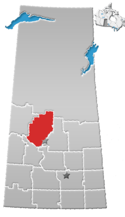 | |
|---|---|---|
| Towns | ||
| Villages | ||
| Resort villages | ||
| Rural municipalities | ||
| Indian reserves |
| |
| Unincorporated communities | ||
This article is issued from
Wikipedia.
The text is licensed under Creative Commons - Attribution - Sharealike.
Additional terms may apply for the media files.