Borden, Saskatchewan
| Borden | |
|---|---|
| Village | |
| Village of Borden | |
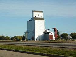 Grain elevator in Borden. | |
 Borden  Borden | |
| Coordinates: 52°24′47″N 107°13′19″W / 52.413°N 107.222°W | |
| Country | Canada |
| Province | Saskatchewan |
| Region | Saskatchewan |
| Census division | 16 |
| Rural Municipality | Great Bend |
| Post office Founded | 1905 |
| Incorporated (Village) | 1909 |
| Fire Dept. | 1941 |
| Government | |
| • Type | Municipal |
| • Governing body | Borden Village Council |
| • Mayor | Colin "Ovi" Elliot |
| • Administrator | Carly Ford |
| Area | |
| • Total | 0.76 km2 (0.29 sq mi) |
| Population (2016) | |
| • Total | 287 |
| • Density | 378.5/km2 (980/sq mi) |
| Time zone | UTC-6 (CST) |
| Postal code | S0K 0N0 |
| Area code(s) | 306 |
| Highways |
Hwy 685 |
| Railways | Canadian National Railway |
| Website | Village of Borden |
| [1][2][3][4] | |
Borden (2016 population 287) is a village within the Rural Municipality of Great Bend No. 405, Saskatchewan, Canada. Borden is named after Sir Frederick William Borden, Minister of Militia in the Laurier Cabinet.[5] An abandoned arch bridge of the same name (Borden Bridge) is located to the southeast and once carried Highway 16 across the North Saskatchewan River.
Demographics
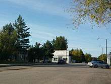
Business district, Shepard Street and First Avenue
| Canada census – Borden, Saskatchewan community profile | |||
|---|---|---|---|
| 2016 | 2011 | 2006 | |
| Population: | 287 (+ 17.1% from 2011) | 245 (+9.9% from 2006) | 223 (-0.9% from 2001) |
| Land area: | 0.76 km2 (0.29 sq mi) | 0.76 km2 (0.29 sq mi) | 0.76 km2 (0.29 sq mi) |
| Population density: | 378.5/km2 (980/sq mi) | 323.1/km2 (837/sq mi) | 294.1/km2 (762/sq mi) |
| Median age: | 46.2 (M: 42.8, F: 52.0) | 47.0 (M: 43.8, F: 49.5) | 48.2 (M: 43.0, F: 55.8) |
| Total private dwellings: | 140 | 120 | 105 |
| Median household income: | $NA | $NA | |
| References: 2016[6] 2011[7] 2006[8] earlier[9] | |||
Notable people
- David Orchard, (born June 28, 1950, in Borden, Saskatchewan) is a Canadian political figure and a member of the Liberal Party of Canada.
See also
Footnotes
- ↑ National Archives, Archivia Net, Post Offices and Postmasters, archived from the original on 2006-10-06
- ↑ Government of Saskatchewan, MRD Home, Municipal Directory System, archived from the original on November 21, 2008
- ↑ Canadian Textiles Institute. (2005), CTI Determine your provincial constituency, archived from the original on 2007-09-11
- ↑ Commissioner of Canada Elections, Chief Electoral Officer of Canada (2005), Elections Canada On-line, archived from the original on 2007-04-21
- ↑ "Geographic Names of Saskatchewan", Bill Barry (2005), p 53.
- ↑ "2016 Community Profiles". Canada 2016 Census. Statistics Canada. February 21, 2017.
- ↑ "2011 Community Profiles". Canada 2011 Census. Statistics Canada. July 5, 2013. Retrieved 2014-06-24.
- ↑ "2006 Community Profiles". Canada 2006 Census. Statistics Canada. March 30, 2011. Retrieved 2009-02-24.
- ↑ "2001 Community Profiles". Canada 2001 Census. Statistics Canada. February 17, 2012.
External links
| Subdivisions | |
|---|---|
| Communities | |
| Cities | |
| Topics |
|
| |
| Cities | 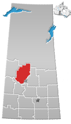 | |
|---|---|---|
| Towns | ||
| Villages | ||
| Resort villages | ||
| Rural municipalities | ||
| Indian reserves |
| |
| Unincorporated communities | ||
Coordinates: 52°24′47″N 107°13′19″W / 52.413°N 107.222°W
This article is issued from
Wikipedia.
The text is licensed under Creative Commons - Attribution - Sharealike.
Additional terms may apply for the media files.