Leoville, Saskatchewan
| Leoville | |
|---|---|
| Village | |
| Village of Leoville | |
 Leoville Location of Leoville in Saskatchewan  Leoville Leoville (Canada) | |
| Coordinates: 53°37′55″N 107°33′04″W / 53.632°N 107.551°W | |
| Country |
|
| Province |
|
| Region | Central |
| Census division | 16 |
| Rural Municipality | Spiritwood No. 496 |
| Post office Founded | 1930 |
| Government | |
| • Type | Municipal |
| • Governing body | Leoville Village Council |
| • Mayor | Ron Craswell |
| • Administrator | Mona Chalifour |
| Area | |
| • Total | 1.11 km2 (0.43 sq mi) |
| Population (2016) | |
| • Total | 375 |
| • Density | 339.2/km2 (879/sq mi) |
| Time zone | UTC-6 (CST) |
| Postal code | S0J 1N0 |
| Area code(s) | 306 |
| Highways |
|
| [1][2][3][4] | |
Leoville is a village within the Rural Municipality of Spiritwood No. 496, in the province of Saskatchewan, Canada. The village is located along Highway 24 (named the worst road in Saskatchewan by the CAA)[5]. Highway 946 begins in the village and proceeds north. Leoville is home to the administrative headquarters of the Pelican Lake First Nation band government. Leoville had a population of 375 in the 2016 Canada Census, (a 2.5% increase from 366 in the 2011 Canada Census).
Demographics
| Canada census – Leoville, Saskatchewan community profile | |||
|---|---|---|---|
| 2016 | 2011 | 2006 | |
| Population: | 375 (2.5% from 2011) | 366 (+7.3% from 2006) | 341 (-0.6% from 2001) |
| Land area: | 1.11 km2 (0.43 sq mi) | 1.11 km2 (0.43 sq mi) | 1.11 km2 (0.43 sq mi) |
| Population density: | 339.2/km2 (879/sq mi) | 331.0/km2 (857/sq mi) | 308.4/km2 (799/sq mi) |
| Median age: | 44.5 (M: 44.6, F: 44.2) | 42.8 (M: 42.8, F: 42.8) | 40.9 (M: 41.0, F: 40.8) |
| Total private dwellings: | 162 | 147 | 156 |
| Median household income: | |||
| References: 2016[6] 2011[7] 2006[8] earlier[9] | |||
See also
References
- ↑ National Archives, Archivia Net, Post Offices and Postmasters, archived from the original on 2006-10-06
- ↑ Government of Saskatchewan, MRD Home. "Municipal Directory System". Archived from the original on 2016-01-15. Retrieved 2009-09-06.
- ↑ Canadian Textiles Institute. (2005), CTI Determine your provincial constituency, archived from the original on 2007-09-11
- ↑ Commissioner of Canada Elections, Chief Electoral Officer of Canada (2005), Elections Canada On-line, archived from the original on 2007-04-21
- ↑ http://www.cbc.ca/news/canada/saskatchewan/highway-24-near-leoville-sask-declared-worst-road-by-caa-1.2626588?
- ↑ "2016 Community Profiles". Canada 2016 Census. Statistics Canada. February 21, 2017. Retrieved 2017-03-15.
- ↑ "2011 Community Profiles". Canada 2011 Census. Statistics Canada. July 5, 2013. Retrieved 2012-10-05.
- ↑ "2006 Community Profiles". Canada 2006 Census. Statistics Canada. March 30, 2011. Retrieved 2012-10-05.
- ↑ "2001 Community Profiles". Canada 2001 Census. Statistics Canada. February 17, 2012.
External links
- Saskatchewan Gen Web - One Room School Project
- Saskatchewan Gen Web Region
- Online Historical Map Digitization Project
- GeoNames Query
- After the Dust a History of Leoville
- La petite histoire d'un aventurier fransaskois (a French Canadian family history)
Places adjacent to Leoville, Saskatchewan | ||||||||||
|---|---|---|---|---|---|---|---|---|---|---|
| ||||||||||
| Subdivisions | |
|---|---|
| Communities | |
| Cities | |
| Topics |
|
| |
| Cities | 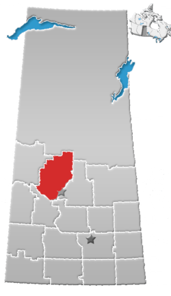 | |
|---|---|---|
| Towns | ||
| Villages | ||
| Resort villages | ||
| Rural municipalities | ||
| Indian reserves |
| |
| Unincorporated communities | ||
This article is issued from
Wikipedia.
The text is licensed under Creative Commons - Attribution - Sharealike.
Additional terms may apply for the media files.