Rosiere, Wisconsin
| Rosière, Wisconsin | |
|---|---|
| Unincorporated community | |
 Rosière Location within the state of Wisconsin | |
| Coordinates: 44°40′32″N 87°36′43″W / 44.67556°N 87.61194°WCoordinates: 44°40′32″N 87°36′43″W / 44.67556°N 87.61194°W | |
| Country | United States |
| State | Wisconsin |
| Counties | Kewaunee, Door |
| Towns | Lincoln, Brussels |
| Elevation | 814 ft (248 m) |
| Time zone | UTC-6 (Central (CST)) |
| • Summer (DST) | UTC-5 (CDT) |
| Area code(s) | 920 |
| GNIS feature ID | 1572620 [1] |
Rosière is an unincorporated community located on the border of Kewaunee County and Door County in Wisconsin, in the towns of Lincoln, and Brussels.[2]
Economy
In 1999, Rosière became the site of the Rosière Wind Farm a wind power site that sits on 30.5 ac (12.3 ha) near the town.[3][4] At its completion the plant was the largest wind farm in the Eastern United States and was built on land leased from landowners in the area.[3][4]
References
- ↑ "Rosière". Geographic Names Information System. United States Geological Survey. Retrieved 2009-07-08.
- ↑ http://wisconsin.hometownlocator.com/wi/door/rosiere.cfm
- 1 2 "Rosière Wind Farm". Madison Gas and Electric. Retrieved 2009-07-08.
- 1 2 "MGE Celebrates 10th Anniversary of State's First Wind Farm". Wisconsin Ag Connection. 2009-07-07. Retrieved 2009-07-08.
Municipalities and communities of Door County, Wisconsin, United States | ||
|---|---|---|
| City | 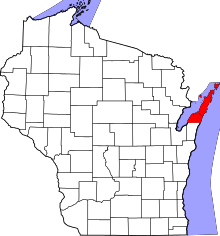 | |
| Villages | ||
| Towns | ||
| CDPs | ||
| Unincorporated communities | ||
| Footnotes | ‡This populated place also has portions in an adjacent county or counties | |
Municipalities and communities of Kewaunee County, Wisconsin, United States | ||
|---|---|---|
| Cities | 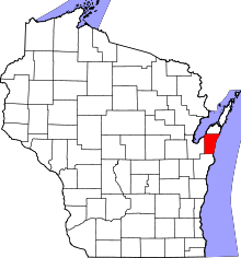 | |
| Villages | ||
| Towns | ||
| CDP | ||
| Unincorporated communities | ||
| Footnotes | ‡This populated place also has portions in an adjacent county or counties | |
This article is issued from
Wikipedia.
The text is licensed under Creative Commons - Attribution - Sharealike.
Additional terms may apply for the media files.