Gregorville, Wisconsin
| Gregorville, Wisconsin | |
|---|---|
| Unincorporated community | |
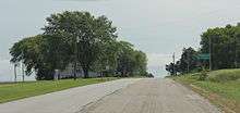
 Looking east at the intersection in Gregorville | |
 Gregorville, Wisconsin  Gregorville, Wisconsin | |
| Coordinates: 44°37′06″N 87°32′47″W / 44.61833°N 87.54639°WCoordinates: 44°37′06″N 87°32′47″W / 44.61833°N 87.54639°W | |
| Country | United States |
| State | Wisconsin |
| County | Kewaunee |
| Elevation | 712 ft (217 m) |
| Time zone | UTC-6 (Central (CST)) |
| • Summer (DST) | UTC-5 (CDT) |
| Area code(s) | 920 |
| GNIS feature ID | 1577621[1] |
Gregorville is an unincorporated community in the Town of Lincoln, Kewaunee County, Wisconsin, United States. It is located at the junction of County Highways P and S 5.5 miles (8.9 km) west of Algoma.[2]

Looking south in Gregorville
The sign for Gregorville
References
- ↑ U.S. Geological Survey Geographic Names Information System: Gregorville, Wisconsin
- ↑ Kewaunee County (PDF) (Map). Wisconsin Department of Transportation. 2018. Retrieved September 22, 2018.
Municipalities and communities of Kewaunee County, Wisconsin, United States | ||
|---|---|---|
| Cities | 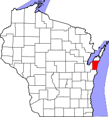 | |
| Villages | ||
| Towns | ||
| CDP | ||
| Unincorporated communities | ||
| Footnotes | ‡This populated place also has portions in an adjacent county or counties | |
This article is issued from
Wikipedia.
The text is licensed under Creative Commons - Attribution - Sharealike.
Additional terms may apply for the media files.