Ridgeland, South Carolina
| Ridgeland, South Carolina | |
|---|---|
| Town | |
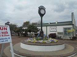 The Ridgeland Street Clock | |
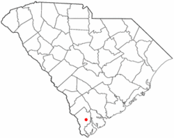 Location of Ridgeland, South Carolina | |
| Coordinates: 32°29′11″N 80°58′48″W / 32.48639°N 80.98000°WCoordinates: 32°29′11″N 80°58′48″W / 32.48639°N 80.98000°W | |
| Country | United States |
| State | South Carolina |
| County | Jasper |
| Government | |
| • Mayor | Joseph Malphrus |
| Area | |
| • Total | 2.4 sq mi (6.3 km2) |
| • Land | 2.4 sq mi (6.2 km2) |
| • Water | 0.0 sq mi (0.0 km2) |
| Elevation | 56 ft (17 m) |
| Population (2010) | |
| • Total | 4,036 |
| • Density | 1,046.6/sq mi (404.1/km2) |
| Time zone | UTC-5 (Eastern (EST)) |
| • Summer (DST) | UTC-4 (EDT) |
| ZIP codes | 29912, 29936 |
| Area code(s) | 843 |
| FIPS code | 45-60280[1] |
| GNIS feature ID | 1250384[2] |
| Website | Ridgeland, South Carolina |
Ridgeland is a town in Jasper County, South Carolina, United States. The population was 4,036 at the 2010 census, a 60% increase from 2000. It has been the county seat of Jasper County[3] since its formation in 1912. As defined by the U.S. Census Bureau, Ridgeland is included within the Hilton Head Island-Bluffton-Beaufort, SC Metropolitan Statistical Area.
Ridgeland is home to the Ridgeland Correctional Institution, a medium security prison operated by the South Carolina Department of Corrections.
Ridgeland was originally known as Gopher Hill in 1894, derived from the "gopher tortoise," which is indigenous to the area but that name was not considered good enough for a new railroad station so it was changed to Ridgeland in 1902 for the fact the town stands upon the highest hill between Charleston and Savannah.[4]
Geography
According to the United States Census Bureau, the town has a total area of 2.4 square miles (6.3 km²), of which 2.4 square miles (6.2 km²) is land and 0.41% is water.[5]
Demographics
| Historical population | |||
|---|---|---|---|
| Census | Pop. | %± | |
| 1910 | 330 | — | |
| 1920 | 418 | 26.7% | |
| 1930 | 715 | 71.1% | |
| 1940 | 1,021 | 42.8% | |
| 1950 | 1,078 | 5.6% | |
| 1960 | 1,192 | 10.6% | |
| 1970 | 1,165 | −2.3% | |
| 1980 | 1,143 | −1.9% | |
| 1990 | 1,071 | −6.3% | |
| 2000 | 2,518 | 135.1% | |
| 2010 | 4,036 | 60.3% | |
| Est. 2016 | 4,141 | [6] | 2.6% |
| U.S. Decennial Census | |||
As of the census[1] of 2000, there were 2,518 people (2,612 in 2004 estimate), 517 households, and 332 families residing in the town. The population density was 1,046.6 people per square mile (403.4/km²). There were 597 housing units at an average density of 248.1 per square mile (95.6/km²). The racial makeup of the town was 44.64% White, 49.17% African American, 0.16% Native American, 0.75% Asian, 4.69% from other races, and 0.60% from two or more races. Hispanic or Latino of any race were 7.63% of the population.
There were 517 households out of which 33.8% had children under the age of 18 living with them, 35.2% were married couples living together, 22.1% had a female householder with no husband present, and 35.6% were non-families. 29.8% of all households were made up of individuals and 14.5% had someone living alone who was 65 years of age or older. The average household size was 2.53 and the average family size was 3.02.
In the town, the population was spread out with 14.9% under the age of 18, 16.6% from 18 to 24, 44.5% from 25 to 44, 15.8% from 45 to 64, and 8.2% who were 65 years of age or older. The median age was 33 years. For every 100 females, there were 279.8 males. For every 100 females age 18 and over, there were 338.2 males. The presence of the Ridgeland Correctional Institution in the town limits heavily skews the sex ratio.
The median income for a household in the town was $27,679, and the median income for a family was $37,647. Males had a median income of $21,900 versus $20,938 for females. The per capita income for the town was $7,394. About 20.0% of families and 24.4% of the population were below the poverty line, including 32.7% of those under age 18 and 14.5% of those age 65 or over.
Education
Ridgeland is home to Ridgeland Elementary School and Ridgeland-Hardeeville High School. Thomas Heyward Academy is a segregation academy located just outside the town limits.[7]
Transportation
Roads


Rail
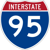
The CSX Railway's Charleston Subdivision (also known as the Charleston-Savannah Railway) currently operates both freight trains and passenger trains (via Amtrak) along the lines, but do not stop at Ridgeland. The line runs along the west side of US 17 until the south end of the I-95 overlap, where it then runs along Nuna Rock Road (Old US 17) until it reaches Coosawhatchie.
Notable people
- LaRue Howard – Gospel musician
- General Lloyd W. Newton - First African-American pilot in the Air Force Thunderbirds
- General Jacob E. Smart - Cold War era USAF general
- Thomas Heyward, Jr. - Signer of the Declaration of Independence
- Reverend Ike, Frederick J. Eikerenkoetter II - Popular and controversial prosperity theology Televangelist.
References
- 1 2 "American FactFinder". United States Census Bureau. Archived from the original on September 11, 2013. Retrieved 2008-01-31.
- ↑ "US Board on Geographic Names". United States Geological Survey. 2007-10-25. Retrieved 2008-01-31.
- ↑ "Find a County". National Association of Counties. Archived from the original on May 31, 2011. Retrieved 2011-06-07.
- ↑ Federal Writers' Project (1938). The Ocean Highway: New Brunswick, New Jersey to Jacksonville, Florida. Works Progress Administration. p. 139.
- ↑ "US Gazetteer files: 2010, 2000, and 1990". United States Census Bureau. 2011-02-12. Retrieved 2011-04-23.
- ↑ "Population and Housing Unit Estimates". Retrieved June 9, 2017.
- ↑ "White Parents Flee Public Schools". Federal Times. Army Times Publishing Company. 1 January 1971.
External links
| Wikimedia Commons has media related to Ridgeland, South Carolina. |
Municipalities and communities of Jasper County, South Carolina, United States | ||
|---|---|---|
| City | 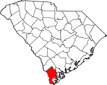 | |
| Town | ||
| Unincorporated communities | ||
| Footnotes | ‡This populated place also has portions in an adjacent county or counties | |
The Lowcountry of South Carolina | ||
|---|---|---|
| Counties |  | |
| Major communities | ||
| Sea Islands | ||
| History & culture | ||
| Military installations | ||
| Natural areas | ||
| Other articles | ||