Rich Mountain (Watauga County, North Carolina)
| Rich Mountain | |
|---|---|
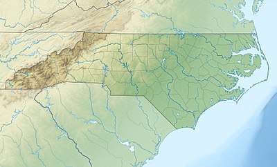
 Rich Mountain Location in North Carolina | |
| Highest point | |
| Elevation | 4,741 ft (1,445 m) [1] |
| Coordinates | 36°14′08″N 81°42′21″W / 36.23556°N 81.70583°WCoordinates: 36°14′08″N 81°42′21″W / 36.23556°N 81.70583°W [1] |
| Geography | |
| Location | Watauga County, North Carolina, U.S. |
| Parent range | Blue Ridge Mountains |
| Topo map | USGS Boone |
Rich Mountain is a mountain located in the North Carolina High Country, northwest of the town of Boone. Its elevation reaches 4,741 feet (1,445 m).
The mountain is sometimes confused with Howard Knob, which is to its immediate east; sharing the same ridge to the west is Snakeden Mountain. Its summit can no longer be reached as the mountaintop became a private gated community in 2010. Visitors can drive to the top of adjacent Howards Knob to access a state park and beautiful views of Boone from above.
The summit of Rich Mountain sports year-round temperatures no warmer than nearby Beech Mountain, one county south in Avery. While Beech Mountain stands 800 feet taller, the unique environment and prevailing winds that channel through a valley just to the North of Rich, bring winter lows that compete with and are occasionally lower than what is generally understood to be the coldest mountain around. With the exception of rugged Grandfather Mountain of course. The summit, and upper north face of Rich Mountain will also receive 50-90% more snow each winter than Boone, just one or two miles south. 68" of snow was recorded during the 2017/2018 winter which sported 3 different snowfalls through the end of April.
One local resident recently installed a "Weather Underground" weather station just 100 feet shy of the summit. This weather station is updated frequently with hyper-local climate information, and can be tracked with the KNCBoone59 wunderground tag, or the "Top of Boone" station name.
The mountain generates several feeder streams to the South Fork New River (via Doe Fork[2]) and the Watauga River (via Laurel Fork[3]).
Rich Mountain #2
A second Rich Mountain[4] is also located south of Boone, near Moses H. Cone Memorial Park. Its elevation reaches 4,199 feet (1,280 m). Because it's within' both the Pisgah National Forest and Blue Ridge Parkway it is protected from development. From 1922-1985, Camp Yonahlossee (Cherokee for "Trail of the Bear") was located at the western side of the mountain, it was one of the oldest all girls camp in North Carolina; today it is a resort and club.[5][6]
The mountain generates several feeder streams to the South Fork New River (via Winkler Creek[7]) and the Watauga River (via Cannon Branch[8]).
References
- 1 2 "Rich Mountain". Geographic Names Information System. United States Geological Survey. Retrieved 2011-09-11.
- ↑ "Doe Fork". Geographic Names Information System. United States Geological Survey. Retrieved 2011-09-11.
- ↑ "Laurel Fork". Geographic Names Information System. United States Geological Survey. Retrieved 2011-09-11.
- ↑ "Rich Mountain". Geographic Names Information System. United States Geological Survey. Retrieved 2011-09-11.
- ↑ "Yonahlossee: History". Archived from the original on 2013-02-10. Retrieved 2011-09-11.
- ↑ "Suzy's Camp Yonahlossee PowWow". Archived from the original on 2012-04-02. Retrieved 2011-09-11.
- ↑ "Winkler Creek". Geographic Names Information System. United States Geological Survey. Retrieved 2011-09-11.
- ↑ "Cannon Branch". Geographic Names Information System. United States Geological Survey. Retrieved 2011-09-11.