Looking Glass Rock
| Looking Glass Rock | |
|---|---|
 | |
| Highest point | |
| Elevation | 3,969 ft (1,210 m) NAVD 88[1] |
| Coordinates | 35°18′13″N 82°47′36″W / 35.3037213°N 82.7934611°WCoordinates: 35°18′13″N 82°47′36″W / 35.3037213°N 82.7934611°W [2] |
| Geography | |
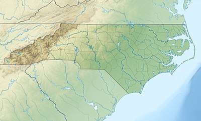 Looking Glass Rock Location in North Carolina | |
| Location | Transylvania County, North Carolina, U.S. |
| Parent range | Appalachian Mountains |
| Topo map | USGS Shining Rock |
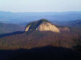
Looking Glass Rock is a pluton monolith in the Appalachian Mountains of western North Carolina. The mountain is located within Pisgah National Forest about 5.5 miles (9 kilometers) northwest of Brevard and 25 miles (40 kilometers) southwest of Asheville. Named for the way its granite face reflects the sunshine, it rises from the valley floor to an elevation of almost 4000 ft.
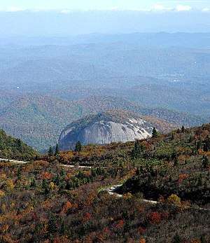
Trails from Forest Service Road 475 and 475B lead to the top of the mountain. It is a moderate/strenuous trail climbing 1700 ft over 3.1 miles to its peak where panoramic views can be seen. There is a flat slab on the top, that can be used as a helipad.[3]
Looking Glass Rock is a popular rock climbing destination. Whether it is free climbing, multi-pitch or aid climbing, dozens of routes traverse the South Face, North Face, Nose Area, Sun Wall, Invisible Wall and Hidden Wall to the top of the mountain.
From the top of Looking Glass Rock, panoramic views can be seen of the Blue Ridge Parkway and surrounding mountains of Transylvania County.
Images
 Blue Ridge Parkway across from Looking Glass Rock
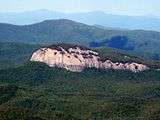 Looking Glass Rock from the Art Loeb Trail (zoom)
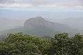 Looking Glass Rock in the rain
 Panorama taken from Looking Glass Rock, 2013
See also
References
- ↑ "Looking Glass Rock, North Carolina". Peakbagger.com. Retrieved 2012-12-26.
- ↑ "Looking Glass Rock". Geographic Names Information System. United States Geological Survey. Retrieved 2012-12-26.
- ↑ Looking Glass Rock Best Hike