Reynoldsburg, Ohio
| Reynoldsburg, Ohio | |
|---|---|
| City | |
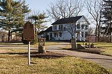
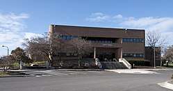 Reynoldsburg City Hall | |
| Motto(s): "The City of Respect" | |
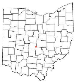 Location of Reynoldsburg, Ohio | |
 Location in Fairfield, Franklin, and Licking Counties | |
| Coordinates: 39°57′36″N 82°48′5″W / 39.96000°N 82.80139°WCoordinates: 39°57′36″N 82°48′5″W / 39.96000°N 82.80139°W | |
| Country |
|
| State |
|
| Counties | Franklin, Licking, Fairfield |
| Government | |
| • Mayor | Brad McCloud (R) |
| Area[1] | |
| • Total | 11.24 sq mi (29.11 km2) |
| • Land | 11.16 sq mi (28.90 km2) |
| • Water | 0.08 sq mi (0.21 km2) |
| Elevation[2] | 879 ft (268 m) |
| Population (2010)[3] | |
| • Total | 35,893 |
| • Estimate (2012[4]) | 36,347 |
| • Density | 3,216.2/sq mi (1,241.8/km2) |
| Time zone | UTC-5 (Eastern (EST)) |
| • Summer (DST) | UTC-4 (EDT) |
| ZIP code | 43068, 43069 |
| Area code(s) | 614 |
| FIPS code | 39-66390[5] |
| GNIS feature ID | 1061597[2] |
Reynoldsburg is a city in Fairfield, Franklin, and Licking counties in the U.S. state of Ohio. It is a suburban community in the Columbus, Ohio metropolitan area. The population was 35,893 at the 2010 census.
History
Reynoldsburg was originally called Frenchtown, and under the latter name was platted in 1831 by John French, and named for him.[6] The present name is for John C. Reynolds, a local merchant.[6] A post office called Reynoldsburg was established in 1833, and the name was changed to Reynoldsburg in 1893.[7]
Geography
According to the United States Census Bureau, the city has a total area of 11.24 square miles (29.11 km2), of which 11.16 square miles (28.90 km2) is land and 0.08 square miles (0.21 km2) is water.[1] Blacklick Creek flows through Reynoldsburg.
Demographics
| Historical population | |||
|---|---|---|---|
| Census | Pop. | %± | |
| 1850 | 309 | — | |
| 1870 | 457 | — | |
| 1880 | 375 | −17.9% | |
| 1890 | 393 | 4.8% | |
| 1900 | 339 | −13.7% | |
| 1910 | 431 | 27.1% | |
| 1920 | 491 | 13.9% | |
| 1930 | 532 | 8.4% | |
| 1940 | 652 | 22.6% | |
| 1950 | 724 | 11.0% | |
| 1960 | 7,793 | 976.4% | |
| 1970 | 13,921 | 78.6% | |
| 1980 | 19,519 | 40.2% | |
| 1990 | 25,748 | 31.9% | |
| 2000 | 32,069 | 24.5% | |
| 2010 | 35,893 | 11.9% | |
| Est. 2017 | 37,847 | [8] | 5.4% |
| Sources:[9][10][11][12][13][14][5][15] | |||
2010 census
As of the census[3] of 2010, there were 35,893 people, 14,387 households, and 9,550 families residing in the city. The population density was 3,216.2 inhabitants per square mile (1,241.8/km2). There were 15,611 housing units at an average density of 1,398.8 per square mile (540.1/km2). The racial makeup of the city was 69.7% White or European American, 23.3% African American, 0.2% Native American, 1.8% Asian, 0.1% Pacific Islander, 1.3% from other races, and 3.5% from two or more races. Hispanic or Latino of any race were 3.4% of the population.
There were 14,387 households of which 35.3% had children under the age of 18 living with them, 45.8% were married couples living together, 15.9% had a female householder with no husband present, 4.7% had a male householder with no wife present, and 33.6% were non-families. 28.0% of all households were made up of individuals and 9.3% had someone living alone who was 65 years of age or older. The average household size was 2.49 and the average family size was 3.06.
The median age in the city was 37.3 years. 26.3% of residents were under the age of 18; 8.1% were between the ages of 18 and 24; 26.8% were from 25 to 44; 27.3% were from 45 to 64; and 11.6% were 65 years of age or older. The gender makeup of the city was 47.4% male and 52.6% female.
2000 census
As of the census[5] of 2000, there were 32,069 people, 12,849 households, and 8,801 families residing in the city. The population density was 3,030.0 people per square mile (1,170.3/km²). There were 13,434 housing units at an average density of 1,269.3 per square mile (490.3/km²). The racial makeup of the city was 85.01% White, 10.44% African American, 1.07% Native American, 1.69% Asian, 0.05% Pacific Islander, 0.74% from other races, and 1.81% from two or more races. Hispanic or Latino of any race were 1.80% of the population.
There were 11,109 households out of which 34.8% had children under the age of 18 living with them, 52.8% were married couples living together, 12.3% had a female householder with no husband present, and 31.5% were non-families. 25.8% of all households were made up of individuals and 7.2% had someone living alone who was 65 years of age or older. The average household size was 2.49 and the average family size was 3.01.
In the city, the population was spread out with 26.6% under the age of 18, 8.0% from 18 to 24, 31.9% from 25 to 44, 23.4% from 45 to 64, and 10.1% who were 65 years of age or older. The median age was 35 years. For every 100 females, there were 91.0 males. For every 100 females age 18 and over, there were 87.0 males.
The median income for a household in the city was $51,108, and the median income for a family was $60,183. Males had a median income of $40,608 versus $30,448 for females. The per capita income for the city was $23,388. About 4.4% of families and 5.5% of the population were below the poverty line, including 7.9% of those under age 18 and 4.4% of those age 65 or over.
Public services and culture
The city currently has six elementary schools, four middle/junior high schools and two high schools, Reynoldsburg High School. The high school and junior high schools' mascot is Rocky Raider (a pirate) and its colors are purple and gold.[16]
The City Parks and Recreation Department is responsible for 275 acres of parkland[17] including 9 major parks.[18] Established in 1948 the first Franklin County Metro Park opened in Reynoldsburg, Blacklick Woods and Blacklick Woods Golf Course; a 643-acre park with Golf, several multi purpose trails, one of the oldest Beech-maple forest in central Ohio, a winter sledding hill, a Nature Center and the Walter A. Tucker State Nature Preserve located inside Blacklick Woods.[19]
The Ohio Department of Agriculture, the Ohio Fire Academy and the State Fire Marshal's offices are also located in Reynoldsburg.
Reynoldsburg is known as "The Birthplace of the Tomato", claiming the first commercial variety of tomato was bred there in the 19th century.[20] and the Tomato Festival has been held every year since 1965. Every year there is a Tomato Festival Queen. The Tomato Festival takes place in August.
Economy
L Brands is the largest employer in Reynoldsburg. Subsequently, its subsidiary Bath & Body Works and Victoria's Secret are headquartered in Reynoldsburg.
Top employers
According to the City's 2009 Comprehensive Annual Financial Report,[21] the top employers in the city are:
| # | Employer | # of Employees |
|---|---|---|
| 1 | Limited Brands Logistics Services | 3,183 |
| 2 | Reynoldsburg City School District | 850 |
| 3 | Victoria's Secret Stores | 552 |
| 4 | Wal-Mart | 470 |
| 5 | State of Ohio | 425 |
| 6 | Bath & Body Works | 418 |
| 7 | Limited Brands Service Corporation | 309 |
| 8 | Dynalab EMS | 245 |
| 9 | Lowe's | 190 |
| 10 | Kroger | 180 |
Notable people
- The rapper Bow Wow attended Hannah J. Ashton Middle School (5th and 6th grades) and Baldwin Road Junior High (7th grade)
- Former St. Louis Cardinals manager and three-time MLB Golden Glove winner Mike Matheny was raised in Reynoldsburg
- Eric Fryer, catcher for St. Louis Cardinals
- Le'Veon Bell, football player for Michigan State and Pittsburgh Steelers
- Aman Ali, Muslim American comedian and storyteller
- Calvin Booth, professional basketball player[22]
References
- 1 2 "US Gazetteer files 2010". United States Census Bureau. Archived from the original on 2012-01-24. Retrieved 2013-01-06.
- 1 2 "US Board on Geographic Names". United States Geological Survey. 2007-10-25. Retrieved 2008-01-31.
- 1 2 "American FactFinder". United States Census Bureau. Retrieved 2013-01-06.
- ↑ "Population Estimates". United States Census Bureau. Archived from the original on 2013-06-17. Retrieved 2013-06-17.
- 1 2 3 "American FactFinder". United States Census Bureau. Retrieved 2008-01-31.
- 1 2 Overman, William Daniel (1958). Ohio Town Names. Akron, OH: Atlantic Press. p. 117.
- ↑ "Post offices". Jim Forte Postal History. Retrieved 19 June 2016.
- ↑ "Population and Housing Unit Estimates". Retrieved May 26, 2018.
- ↑ "Population of Civil Divisions Less than Counties" (PDF). Statistics of the Population of the United States at the Tenth Census. U.S. Census Bureau. Retrieved 28 November 2013.
- ↑ "Population of Civil Divisions Less than Counties" (PDF). Statistics of the Population of the United States at the Tenth Census. U.S. Census Bureau. Retrieved 28 November 2013.
- ↑ "Population: Ohio" (PDF). 1910 U.S. Census. U.S. Census Bureau. Retrieved 28 November 2013.
- ↑ "Population: Ohio" (PDF). 1930 US Census. U.S. Census Bureau. Retrieved 28 November 2013.
- ↑ "Number of Inhabitants: Ohio" (PDF). 18th Census of the United States. U.S. Census Bureau. Retrieved 22 November 2013.
- ↑ "Ohio: Population and Housing Unit Counts" (PDF). U.S. Census Bureau. Retrieved 22 November 2013.
- ↑ "Incorporated Places and Minor Civil Divisions Datasets: Subcounty Population Estimates: April 1, 2010 to July 1, 2012". U.S. Census Bureau. Archived from the original on 17 June 2013. Retrieved 25 November 2013.
- ↑ http://www.reyn.org/
- ↑ http://www.ci.reynoldsburg.oh.us/departments/parks-and-recreation.aspx
- ↑ http://www.ci.reynoldsburg.oh.us/departments/parks-and-recreation/parks-facilities.aspx
- ↑ http://www.metroparks.net/parks-and-trails/blacklick-woods/
- ↑ About Reynoldsburg Archived 2011-01-11 at the Wayback Machine., City of Reynoldsburg. Retrieved 2012-04-18.
- ↑ "City of Reynoldsburg CAFR" (PDF). Archived from the original (PDF) on 2010-11-15. Retrieved 2010-12-12.
- ↑ "Calvin Booth". ESPN.com. Retrieved 2018-02-02.
External links

- City website
- Reynoldsburg Visitors and Community Activities Bureau
- Reynoldsburg Division of Police
- Reynoldsburg Tomato Festival official site
- Reynoldsburg Area Chamber of Commerce official site
Municipalities and communities of Fairfield County, Ohio, United States | ||
|---|---|---|
| Cities | 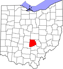 | |
| Villages | ||
| Townships | ||
| CDPs | ||
| Unincorporated communities | ||
| Footnotes | ‡This populated place also has portions in an adjacent county or counties | |
Municipalities and communities of Franklin County, Ohio, United States | ||
|---|---|---|
| Cities | 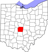 | |
| Villages | ||
| Townships | ||
| CDPs | ||
| Unincorporated communities | ||
| Footnotes | ‡This populated place also has portions in an adjacent county or counties | |
Municipalities and communities of Licking County, Ohio, United States | ||
|---|---|---|
| Cities | 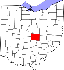 | |
| Villages | ||
| Townships | ||
| CDPs | ||
| Unincorporated communities | ||
| Ghost towns | ||
| Footnotes | ‡This populated place also has portions in an adjacent county or counties | |
| Authority control |
|---|