Reile's Acres, North Dakota
| Reile's Acres, North Dakota | |
|---|---|
| City | |
 | |
 Reile's Acres, North Dakota Location within the state of North Dakota | |
| Coordinates: 46°55′33″N 96°51′46″W / 46.92583°N 96.86278°WCoordinates: 46°55′33″N 96°51′46″W / 46.92583°N 96.86278°W | |
| Country | United States |
| State | North Dakota |
| County | Cass |
| Founded | 1977 |
| Government | |
| • Mayor | Shane Amundson |
| Area[1] | |
| • Total | 0.48 sq mi (1.24 km2) |
| • Land | 0.48 sq mi (1.24 km2) |
| • Water | 0 sq mi (0 km2) |
| Elevation | 892 ft (272 m) |
| Population (2010)[2] | |
| • Total | 513 |
| • Estimate (2016)[3] | 594 |
| • Density | 1,100/sq mi (410/km2) |
| Time zone | UTC-6 (Central (CST)) |
| • Summer (DST) | UTC-5 (CDT) |
| ZIP code | 58102 |
| Area code(s) | 701 |
| FIPS code | 38-66040 |
| GNIS feature ID | 1037272[4] |
| Website | http://reilesacresnd.org |
Reile's Acres is a city in Cass County, North Dakota, United States. The population was 513 at the 2010 census.[5] It is a suburb of Fargo. Reile's Acres was founded in 1977.
History
On Tuesday, February 22, 1977 at 9:30 Reile's Acres was incorporated as a city by order of the Cass County ND Commission . With a population of 147 and has slowly grown ever since. In 1976, just before the incorporation, the new city had 31 homes with a total value of $164,248.00 or an average value of roughly $5,300.00 per home. Reile's Acres is named for Reinhold Reile who originally owned the land and had a farmstead on the site. Therefore, the city is properly referred to with the apostrophe in Reile's. The move toward incorporation came about when the development of Reile's Acres reached a point where the Reed Township Board could not handle the costs of road maintenance in the small, heavily populated area about a mile north and a mile west of Fargo. Residents of the Reile's Acres area said that through incorporation, the subdivision could get state and federal funds as well as tax money to take care of streets and roads.
On April 26, 1977 Reile's Acres held its very first election held at the Clark Zick residence. 52 of the 82 eligible voters participating in the election chose Jim Lutz mayor, with 37 votes, the city chose 4 council members that night as well. Clarence Paschka, Susan Cleary, Millie Tarieski and David Domier were the city's choices for 4 and 2 year terms.
Geography
According to the United States Census Bureau, the city has a total area of 0.48 square miles (1.24 km2), all of it land.[1]
Demographics
| Historical population | |||
|---|---|---|---|
| Census | Pop. | %± | |
| 1980 | 191 | — | |
| 1990 | 210 | 9.9% | |
| 2000 | 254 | 21.0% | |
| 2010 | 513 | 102.0% | |
| Est. 2016 | 594 | [3] | 15.8% |
| U.S. Decennial Census[6] 2015 Estimate[7] | |||
2010 census
As of the census[2] of 2010, there were 513 people, 146 households, and 137 families residing in the city. The population density was 1,068.8 inhabitants per square mile (412.7/km2). There were 147 housing units at an average density of 306.3 per square mile (118.3/km2). The racial makeup of the city was 98.4% White, 0.2% African American, 0.2% Native American, 0.8% Asian, 0.2% from other races, and 0.2% from two or more races. Hispanic or Latino of any race were 0.8% of the population.
There were 146 households of which 61.0% had children under the age of 18 living with them, 92.5% were married couples living together, 0.7% had a female householder with no husband present, 0.7% had a male householder with no wife present, and 6.2% were non-families. 4.1% of all households were made up of individuals and 0.7% had someone living alone who was 65 years of age or older. The average household size was 3.51 and the average family size was 3.64.
The median age in the city was 34 years. 37.8% of residents were under the age of 18; 4.1% were between the ages of 18 and 24; 33.3% were from 25 to 44; 22.2% were from 45 to 64; and 2.5% were 65 years of age or older. The gender makeup of the city was 49.9% male and 50.1% female.
2000 census
As of the census of 2000, there were 254 people, 72 households, and 68 families residing in the city. The population density was 528.6 people per square mile (204.3/km²). There were 72 housing units at an average density of 149.8 per square mile (57.9/km²). The racial makeup of the city was 98.43% White, 0.79% Native American, and 0.79% from two or more races.
There were 72 households out of which 62.5% had children under the age of 18 living with them, 88.9% were married couples living together, 4.2% had a female householder with no husband present, and 4.2% were non-families. 4.2% of all households were made up of individuals and none had someone living alone who was 65 years of age or older. The average household size was 3.53 and the average family size was 3.59.
In the city, the population was spread out with 37.8% under the age of 18, 6.7% from 18 to 24, 29.5% from 25 to 44, 24.4% from 45 to 64, and 1.6% who were 65 years of age or older. The median age was 33 years. For every 100 females, there were 95.4 males. For every 100 females age 18 and over, there were 92.7 males.
The median income for a household in the city was $67,708, and the median income for a family was $68,958. Males had a median income of $46,250 versus $28,750 for females. The per capita income for the city was $22,367. About 4.2% of families and 2.4% of the population were below the poverty line, including none of those under the age of eighteen and 100.0% of those sixty five or over.
Law and government
Reile's Acres uses the city commission style of government. Four commissioners and a mayor are elected at large. The current mayor is Shane Amundson. The commission meets monthly. One municipal judge is also elected at large.
Reile's Acres fire services are provided by nearby West Fargo through an agreement.
Economy
Reile's Acres does not have any commercial enterprise within the city limits. Workers commute to the Fargo-Moorhead area or beyond.
Recreation
Reile's Acres has two city parks, one located off of 35th Avenue which provides playground equipment, picnic areas, tennis courts, an ice skating rink, a baseball diamond and other typical park amenities. The city park shelter contains the city office and typically serves as the home of city commission meetings. The other park is located off of Landview Road and contains playground equipment and a picnic area.
Education
All K-12 children attend either the West Fargo School District, the North Fargo School District or the Northern Cass School District.
References
- 1 2 "US Gazetteer files 2010". United States Census Bureau. Archived from the original on 2011-02-20. Retrieved 2012-06-14.
- 1 2 "American FactFinder". United States Census Bureau. Retrieved 2012-06-14.
- 1 2 "Population and Housing Unit Estimates". Retrieved June 9, 2017.
- ↑ "US Board on Geographic Names". United States Geological Survey. 2007-10-25. Retrieved 2008-01-31.
- ↑ "2010 Census Redistricting Data (Public Law 94-171) Summary File". American FactFinder. United States Census Bureau. Retrieved 2 May 2011.
- ↑ "U.S. Decennial Census". Census.gov. Retrieved May 26, 2013.
- ↑ "Population Estimates". United States Census Bureau. Archived from the original on October 19, 2016. Retrieved June 24, 2016.
External links
Municipalities and communities of Cass County, North Dakota, United States | ||
|---|---|---|
| Cities | 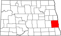 | |
| Townships | ||
| CDPs | ||
| Unincorporated communities | ||
| Footnotes | ‡This populated place also has portions in an adjacent county or counties | |
| Counties | ||
|---|---|---|
| Main cities | ||
| Surrounding areas |
| |
‡ - county seat | ||