Ratlam district
| Ratlam district | |
|---|---|
| District of Madhya Pradesh | |
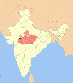 Location of Ratlam district in Madhya Pradesh | |
| Country | India |
| State | Madhya Pradesh |
| Administrative division | Ujjain |
| Headquarters | Ratlam |
| Tehsils | 8 |
| Government | |
| • Lok Sabha constituencies | Ratlam |
| Area | |
| • Total | 4,861 km2 (1,877 sq mi) |
| Population (2011) | |
| • Total | 1,500,000 |
| • Density | 310/km2 (800/sq mi) |
| Demographics | |
| • Literacy | 68.03 per cent |
| • Sex ratio | 973 |
| Major highways | NH 79, NH 927A |
| Website | Official website |
Ratlam District is a district of Madhya Pradesh state in central India. The town of Ratlam is administrative headquarters of the district.
Geography
Ratlam District has an area of 4,861 square kilometres (1,877 sq mi). It is bounded by Mandsaur District to the north, Jhalawar District of Rajasthan state to the northwest, Ujjain District to the east, Dhar District to the south, Jhabua District to the southwest, and Chittorgarh District of Rajasthan to the west. It is divided into five tehsils and is home to 9 towns and 1,063 villages (as of 2001). The district is part of Ujjain Division.[1]
History
Ratlam District was created after Indian independence in 1947, out of the territory of several princely states, including Ratlam State, Jaora, Sailana, Piploda, and portions of Dewas Junior, Dewas Senior, and Gwalior, as well as the former province of Panth-Piploda. Ratlam District was part of the new state of Madhya Bharat. Ratlam is known for Garadu (an eatable), Sev and Gold. Also, it has a DRM office of Railway.In 1956, Madhya Bharat was merged into Madhya Pradesh state.[1]
Demographics
According to the 2011 census Ratlam District has a population of 1,455,069 [2] roughly equal to the nation of Swaziland[3] or the US state of Hawaii.[4] This gives it a ranking of 342nd in India (out of a total of 640).[2] The district has a population density of 299 inhabitants per square kilometre (770/sq mi) .[2] Its population growth rate over the decade of 2001-2011 was 19.67%.[2] Ratlam has a sex ratio of 973 females for every 1,000 males,[2] and a literacy rate of 68.03%.[2]
References
- 1 2 "Ratlam". Ratlam district administration. Retrieved 2010-08-12.
- 1 2 3 4 5 6 "District Census 2011". CensusIndia.co.in. 2011.
- ↑ US Directorate of Intelligence. "Country Comparison:Population". Retrieved 2011-10-01.
Swaziland 1,370,424
- ↑ "2010 Resident Population Data". U. S. Census Bureau. Retrieved 2011-09-30.
Hawaii 1,360,301
External links

Places adjacent to Ratlam district | |
|---|---|
Coordinates: 23°19′48″N 75°02′24″E / 23.33000°N 75.04000°E